Author: Mike
Hassur
 Westside Road, which is located 0.9 of a mile inside of Mt. Rainier’s Nisqually Entrance, was
originally intended to be a portion of a road system that connected the
Nisqually and Carbon River/Mowich Lake areas of Mt. Rainier. Political squabbles between Pierce County,
Washington State, and the federal government derailed the original project
after completion of the Westside Road in the early 1930’s. Westside Road, as it now stands, is a gravel
road that extends approximately 13 miles up over Round Pass, down the other
side and then climbs again up to Klapatche Point http://aroundguides.com/23945458/Map
). Typically, you drive the first 3
miles of the road to the point where it is blocked to automobiles due to
washouts and rock falls – time to get out the bikes. The former parking area for vehicles, which
was just a couple of hundred yards further up the road, was closed in May of
this year due to a boulder bouncing down the mountain and crushing an
unoccupied truck (see
this short article and accompanying photo ).
Westside Road, which is located 0.9 of a mile inside of Mt. Rainier’s Nisqually Entrance, was
originally intended to be a portion of a road system that connected the
Nisqually and Carbon River/Mowich Lake areas of Mt. Rainier. Political squabbles between Pierce County,
Washington State, and the federal government derailed the original project
after completion of the Westside Road in the early 1930’s. Westside Road, as it now stands, is a gravel
road that extends approximately 13 miles up over Round Pass, down the other
side and then climbs again up to Klapatche Point http://aroundguides.com/23945458/Map
). Typically, you drive the first 3
miles of the road to the point where it is blocked to automobiles due to
washouts and rock falls – time to get out the bikes. The former parking area for vehicles, which
was just a couple of hundred yards further up the road, was closed in May of
this year due to a boulder bouncing down the mountain and crushing an
unoccupied truck (see
this short article and accompanying photo ).(


Les and I got our bikes unpacked from my van and headed
up the road through the “rock fall” area.
These are NOT rocks. They are
large boulders that - in some cases - hurtle down the slide area, launch
themselves off the large boulders at the base of the slide area, and land in
the roadway leaving large “craters” where they land. Impressive!!

 |
| Les in the "crater" left where this boulder impacted the road... |


Not far past the “rock fall” area, we encountered a
stream that had to be crossed. It was
not a particularly wide stream, and it was shallow; but neither Les nor I
entertained any thoughts of riding across.
The rocks in the stream bed were mossy and slick, and we knew how that
story would end. Had Dwaine Trummert and
Scott Larson been with us, we figured we would have had some photos of guys
riding across. Fortunately for us, there
was a bridge of sorts – a narrow log with a shaky rail. We just had to figure out how to keep
ourselves AND THE BIKES on that log as we crossed. It was Les who came up with the idea to hold
onto the handlebars and lead his bike across.
Les’ idea worked great, and we were soon heading on up the road.
 |
| Crossing narrow log bridge using the "Les Becker Method"... |
We climbed steadily for a few miles until we came to
Round Pass. The trailhead for Lake
George and Gobbler’s
Knob is located here. No trails for
us today. We just headed down the other
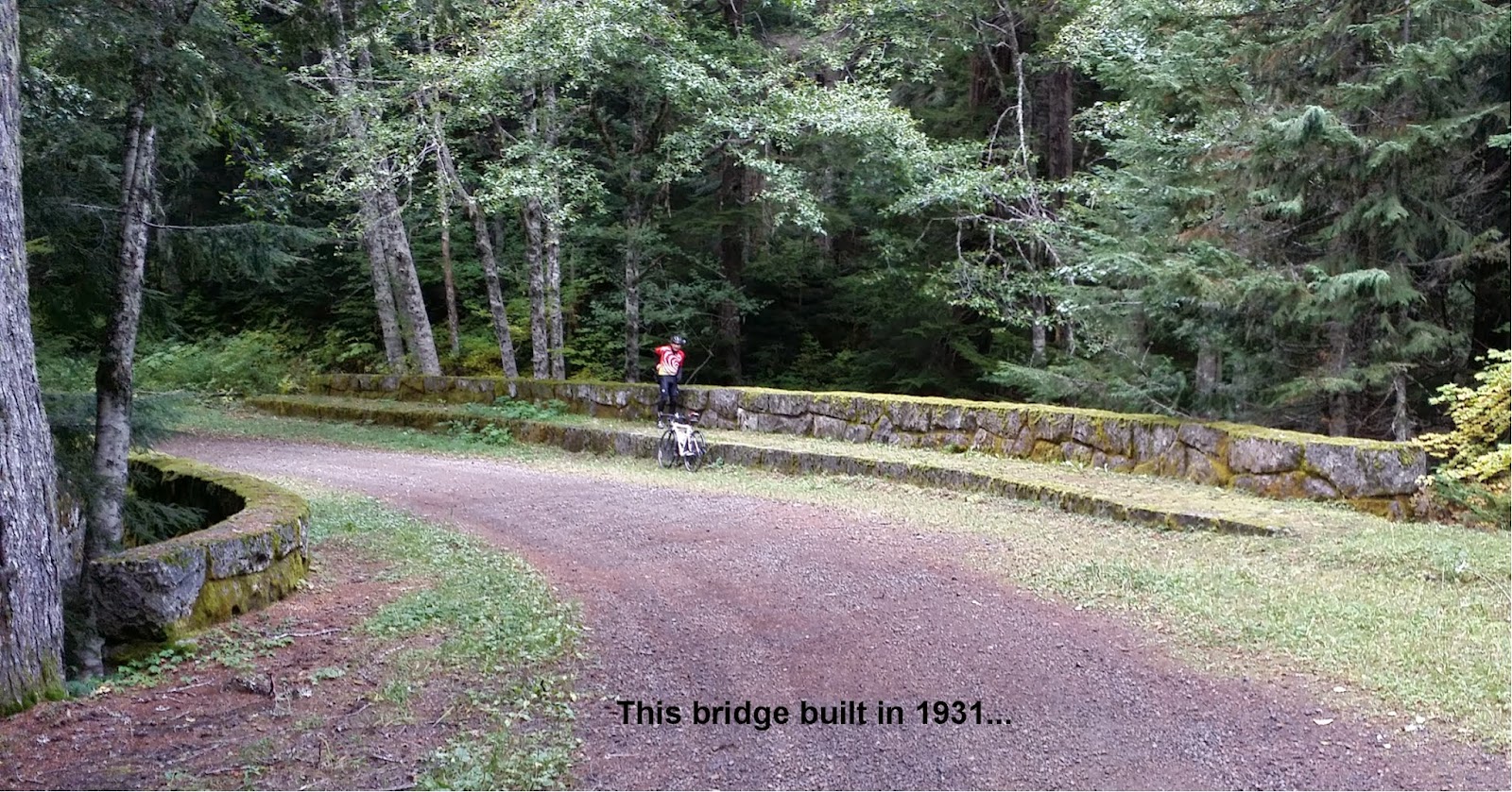
side of Round Pass. After descending for
a couple of miles, we crossed a moss covered stone bridge (The South Puyallup
River Bridge) that was built around 1931 as part of the original Westside
Road Project. The bridge was in remarkably
good shape and was very distinctive in its appearance (it’s in the National
Historic Registry).

After stopping and taking some photos, we were soon
climbing again. A brief rain shower made
us take refuge under some roadside trees.
The shower only lasted about two minutes; but, during the stop we
discovered some beautiful mushrooms.

Back on the road, we soon crossed the St. Andrews Creek Bridge
– another stone bridge similar to The South Puyallup River Bridge. This bridge was different in that it included
steps that allowed you to walk right down to the river below – very cool.


After exploring the St. Andrews Creek Bridge and taking
photos, we resumed climbing toward Klapatche Point which was the
end of the road and the highest point on our ride at 4160 feet. The climb went smoothly, and we were soon
enjoying the views from the end of the road.

Retracing our path back to the cars was fun (mostly
downhill) and uneventful.


I purposely did not send out an email to everyone about this ride; because it had been 15 years or so since I had last been on this road, and I was not certain what condition it was in. I didn’t want to drag 6 – 8 guys up here and have the ride be a disappointment. Now, having scouted the road, I think that any of us who have a mountain bike or cyclocross bike or even a road bike with 30-35 mm tires would enjoy doing this ride.
I purposely did not send out an email to everyone about this ride; because it had been 15 years or so since I had last been on this road, and I was not certain what condition it was in. I didn’t want to drag 6 – 8 guys up here and have the ride be a disappointment. Now, having scouted the road, I think that any of us who have a mountain bike or cyclocross bike or even a road bike with 30-35 mm tires would enjoy doing this ride.
Plan on us trying
to make this a group ride next year.
To see all of the photos associated with this ride, click
on the following link: https://plus.google.com/photos/103821724300588557330/albums/6066586119275518033?banner=pwa
No comments:
Post a Comment