Sunday, August 26, 2018

2018_08_23 "Rainiering" Ride (Adam, Les, Leon, Scott, and Mike)


Author:  Mike Hassur


For anyone who isn't familiar with the term, "Rainiering" (at least for our cycling group) means to do a one day ride that includes an elevation gain equal to or greater than the height of Mt. Rainier (i.e. 14,411').  The ride does not have to involve Mt. Rainier.  It can be done anywhere.

The plan for this year's Rainiering Ride evolved to include every "road cycling" climb on Mt. Rainier thanks to Adam's suggestion that we add the climb to Paradise from the Longmire side of the mountain.  Les, then, suggested that we do the "Paradise Leg" first to reduce our exposure to traffic on the portion from Cougar Campground to Paradise which can be quite busy.  Both suggestions proved to be worthwhile.  I had always wanted to do all of the climbs on Mt. Rainier in one ride, and doing the potentially busiest portion early in the day really decreased the volume of traffic with which we had to deal.

Our ride started at Grove of the Patriarchs on the east side of Mt. Rainier and consisted of two legs:

  1. Leg #1:  Grove of the Patriarchs (GoP) --> up Backbone Ridge --> up through Stevens Canyon and above to Reflection Lake --> up to Paradise --> descend the west side of the mountain to Cougar Rock Campground (near Longmire) --> turn around and retrace our steps back up the west side of the mountain to Reflection Lake and down the east side of the mountain through Stevens Canyon and up and over Backbone Ridge back to our vehicles to restock with food and drink...
  2. Leg #2:  Grove of the Patriarchs (GoP) --> up the south side of Cayuse Pass --> up Chinook Pass --> back down to Cayuse Pass and over to the climb to Sunrise Visitor Center --> climb up to Sunrise Visitor Center --> retrace our steps back down Sunrise climb and up north side of Cayuse Pass --> descend back to vehicles
The week or two preceding this ride had seen a lot of smoke move into our region from forest fires located in British Columbia.  There was enough smoke that health alerts had been issued for our area, and people were advised not to over-exert themselves... this did not seem to be in keeping with our plan to ride 127 miles or so on the climbs of Mt. Rainier!!  We simply agreed that, if the smoke seemed to cause a problem for any of us on the ride, we would discontinue the ride.

Les showed up threatening to wear this "apparatus" as protection from the smoke...

Our starting point, The Grove of the Patriarchs Parking Lot, is about a 1.5 to 2 hour drive from our homes.  Our plan was to be on our bikes by around 6:30 AM (sunrise was around 6:15 AM that morning) which meant that most of the drive to the starting point was in the dark.  As I got up into the mountains, I noted that the smoke was worse than I had anticipated - the valleys were full of smoke.  I wondered if the smoke might actually cause us problems.

I arrived at GoP about 30 minutes early - AND FOUND THAT ADAM, SCOTT AND LEON WERE ALREADY THERE!!  Geez guys... did you spend the night there??!!  Soon, Les arrived as well; and we were leaving on our bikes by around 6:40 AM.

6:40 AM;  ready to go...

Our first climb was up the east side of Backbone Ridge.  There are usually some great views of the valleys near the top of this climb - but not today.  The smoke was so thick that you couldn't see the valleys.  Luckily, none of our group seemed to be affected by the smoke.  Whether this was strictly smoke or smoke mixed with fog was hard to tell.  I suspect that there was some fog as well, because my glasses "fogged up" slightly on the way down the west side of Backbone Ridge.

Next up, the climb up through Stevens Canyon and above to get us to Reflection Lake. The road through Stevens Canyon is perpendicular to the mountain's "fall line" which means there is a cliff on your left and rock faces on your right.  We came upon an area where boulders from the cliff face to our right had fallen on the road and shattered.  Interestingly, when we returned through this area a few hours later, more rocks had fallen onto the road.  Glad we weren't there when it happened!!  Again, the valleys were filled with smoke; but it wasn't as thick, and you could begin to see patches of blue sky ahead. 

Boulders that fell from the cliff above and smashed into our road...

Stevens Canyon ascent... still lots of smoke, but starting to clear a bit...


By the time that we were nearing Reflection Lake, we had ridden up out of the smoke.  There was still some haze but not nearly as bad.  We paused at the lake to take some photos; and, then, proceeded past Inspiration Point and on up to Paradise.

Adam nearing Reflection Lake with a slightly hazy Mt. Rainier in the background...
Scott near Reflection Lake...

From front to back:  Adam, Scott, Les, & Leon near Reflection Lake...

Reflection Lake...

Leon, Scott, Adam, and Mike at Reflection Lake...

Between Reflection Lake and Inspiration Point:  Mt. Rainier looms large...

We stopped, briefly, at Paradise to fuel up with food and drink and hit the bathrooms.  After that, we started down the 9.5 mile descent of the west side of the mountain to Cougar Rock Campground (just above Longmire).  The descent was fast, fun, and is shown in the video that was made from this ride.  At Cougar Rock, we turned around and began the ascent that would retrace our steps back up the mountain to Inspiration Point and Reflection Lake, back down the east side of the mountain, up and over Backbone Ridge, and back to our vehicles (the end of Leg #1).

We have now climbed back up the west side of the mountain and are preparing to head east to Inspiration Point, Reflection Lake, etc....

Les and Leon near Inspiration Point...

View from Inspiration Point...
Narada Falls as seen from Inspiration Point...

View of Mt. Rainier from Inspiration Point...

We are just past Reflection Lake and beginning down the east side of the mountain (and back into the smoke... though it was dissipating)...

Leon and Mike cresting Backbone Ridge as we near the conclusion of Leg #1 of our ride...

Leon decided not to do Leg #2 of our ride.  He had just returned from a trip to Africa where he gained 10 pounds and hadn't had much of a chance to train for the previous 2-3 weeks.  He opted to head back up Backbone Ridge a few times and ended up with over 9,000' of climbing.  Not bad for someone who considered himself "out of shape"!!

After refueling at the vehicles, we began Leg #2 by ascending the south side of Cayuse Pass and west side of Chinook Pass.  It seemed that all of us were still feeling fairly strong at this point of the ride.

Les and Scott heading up the climb to Chinook Pass...

Adam, Scott, and Les with the top of Chinook Pass in sight...

Mike, Les, Adam, and Scott  at the top of Chinook Pass...


From Chinook Pass, our route took us back down to Cayuse Pass and down the north side of Cayuse Pass to the road to Sunrise (and the 14-15 mile climb from the ranger station to the Sunrise Visitor Center).  There are no photos from this climb, because we were starting to feel fatigued and didn't have the energy (or will-power) to pull our cameras out for photos.  This climb is difficult anyway, and doing it when you are already tired is a grind.  At the visitor center, we stopped for gel packs and Gatorade. 

Adam, Scott, and Les at Sunrise...

Sunrise Visitor Center "Snack Bar"...

After retracing our path back down the Sunrise Climb, we had one final climb to negotiate - the 3-4 miles up the north side of Cayuse Pass.  Ordinarily, this is an easy climb; but we were tired.  Fortunately, we made it up pretty easily and faced only twelve or so miles (all downhill) to get back to our vehicles - awesome!!

Garmin data:  127 miles,  14,532' climbing...

Les, Mike, and Scott - glad to be done...


Great ride and great group - take THAT smoke...!!!


Friday, August 24, 2018

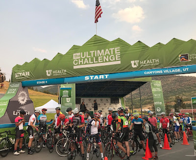
2018_08_11 The Ultimate Challenge (Tour of Utah)

Author: Les Becker

I visit Salt Lake City frequently to visit my daughter, son-in-law, and our two grandsons. This beautiful city attracts many high level athletes due to it's nearby world class skiing, mountain biking and other sports including road biking. In August the Tour of Utah, a 1 week professional stage race, takes place in and near SLC. They also sponsor a one day gran fondo called The Ultimate Challenge that exactly follows one of the stages in the pro race. This year it was stage 5, the Queen Stage, and starting at 7:30 which was 4 hours ahead of the pros. Seems like a big head start until considering the stage is 100 miles with 10,000 feet of climbing with the entire event taking place between 5,000 and 10,000 feet. Oh, SLC can be hot in August too.


I arrived in SLC 5 days prior to the event hoping the 4500 ft elevation there would help me to acclimate. The next day, for reconnaissance, I rode Little Cottonwood Canyon to Snowmass, the mountain top finish of the race. This reminded me of the difficulty of riding consistent 10-12% grade and realized my 30 tooth rear cog was clearly not adequate. So I quickly found a shop where they replaced it with a 11-32 casette, a small but significant change. The other big climb in the event was Guardsman Pass topping at nearly 10,000 feet. I had not ridden it from that direction before and with what research I could find, concluded it was not as steep as Little Cottonwood (not true). During the ensuing days, I agitated on how long this ride would take and if I could finish w/out being caught by the pros. If that happened, you would be required to stop and watch from the shoulder until all pros passed and then proceed if there was time or abandon. The many unknown factors made this calculation difficult and certainly gave me reason for worry.


The day came, I got up and drove to Park City in the dark, looking for Canyonlands Resort parking lot. Succeeded, found the packet pick-up, dropped my bag to be transported to the finish line and got on the chair lift with my bike that carried us a short distance to the start. At 60 deg, I dressed light. Since all the "real climbing" was in the final 35 miles, we initially rode 65 miles in beautiful valleys, over rollers and even a 2 mile stretch of gravel. My plan was to be very careful to save energy for the daunting climbs to come, but at one point, where Garmin said level road and I was feeling great, I noticed the small group I was riding with was doing 30mph. Oops.

I left the food stop at the base of guardsman pass alone and when came to a round-about, followed what looked like the logical main uphill spoke. After couple hundred feet another biker (not in the race) said, "Oh, you need to go up that road" pointing to a narrow spoke that was so steep, I could only imagine it was a driveway. Up I went, grinding, pushing the pedals, no relief. Went past condos & chair lifts but no respite in the 10-12% grade and temperature rising. Clearly this was as steep as LC. Soon exhausted, everyone panting, groaning, obviously all in their own deep suffering. No way I could drink while trying to push each peddle stroke, so couple times briefly got off the bike to quickly eat & drink as did many others. Then would walk a few feet, but those riding past me were not going much faster. Many places on the climb had spectators watching and usually cheering and encouraging us. At one point I saw a white Sienna parked at the entrance to a driveway and in my near delirious state, briefly thought I could be my wife coming to cheer me on. In that moment I seriously knew that if it were indeed her, I would not be able to continue but would put my bike in the car and go home. During the preceding week I had prepared myself for the possibility of having to report the pros caught me on Little Cottonwood so I couldn't complete the ride. But how could I tell my riding buddies that I didn't even make it up the first climb?

Eventually I crested a pass, began descending a more welcoming forested slope that I recognized from when I saw this side of Guardsmans last fall. But quickly came to a support tent with a lot of riders getting more water and I thought "what a stupid idea to put a support stop at the beginning of a long descent." At the same time the road bent upwards and soon was not only back to the 12% grade but very course pavement, somewhat broken up, making border between road and shoulder indistiguishable. Drat, that was not the top! Another 1,000 feet of agonizing climbing brought me to the summit and I collapsed into a descending position for the 5,000 ft drop. I took full advantage of the food/water stop at the base of Little Cottonwood, the final 3,000 ft climb to the finish line. Then proceeded up the hill and into the heat to see if my legs had anything left. Many volunteers along the ascent offered water, ice, food. My Garmin showed temp up to 105 deg. "No I don't want a hot dog, but do please poor the ice water over my head and down my jersey." The ice cubes that mercifully caught in my jersey provided some ongoing comfort. Again, could not pedal and drink concurrently on much of this climb, so stopped 3-4 times for brief guzzling from bottles and taking power gels.

One thing I didn't anticipate was the throng of spectators lining the last mile. Of course they were waiting for the pros but were already excited and would jump into the road to shout encouragement and throw mist or water at us. One even gave me a push! I had no inclination of declining that. I knew they were there for the pros, but was fun to pretend they were there for me. About 100 meters from the finish I had a screaming abrupt killer cramp in my right thigh. I thought, great, rode 100 hard miles only to be taken down by a cramp in the last kilometer. But I shook my leg and was able to proceed. Out of the saddle, surprisingly felt better than seated. The gentle slope into the ski resort allowed me to cross the finish line with a little speed. All I can say about placement is that my time up Little Cottonwood was probably #4 in my age bracket, but they did not say out of how many. I suspect many were caught by the pros. I was pleased I had enough physical and mental energy to persist through the miles of unfamiliar terrain, the steep grades, the heat and the elevation.

I was not so much relieved at the finish, but rather dazed and needed to just let go of the intensity. I have never felt this depleted. I called my wife as promised and in a shaky voice told her I was OK then got chips and a coke and watched on an outdoor bigscreen the pro Sepp Kuss charging up the climb in first place, arriving 45 minutes after me. He was looking a lot better than I felt! Now I have an even more profound appreciation of what the pros can do. My right calf became very painful immediately after finishing; not sure why, but did last 2-3 days. Had a little residual pain from my thigh cramp. But mostly, was mentally exhausted. My body and mind both wanted to collapse and I welcomed the coming week off the bike.


Thursday, August 16, 2018

2018_08_11 Port Angeles/Hurricane Ridge Weekend

Author:  Mike Hassur


Okay, this is the way that the weekend was planned:
·      -  Arrive on Friday afternoon
·      -   Hurricane Ridge on Saturday morning
·       -  Adam and I spend Saturday night in his RV (Dwaine with his family in their trailer)
·       -  A leisurely ride on the Olympic Discovery Trail on Sunday morning
·       -  Head home

Now here is what actually happened.  Due to family obligations and vacations, a lot of our group was not available for this ride.  We ended up with just three guys (Dwaine, Adam, and Mike). We’d had a long string of days that were hot and dry leading up to this weekend; so, of course, “Hurricane Ridge day” (Saturday) had lightning and rain forecast for most of the day at Hurricane Ridge.  Being on top of a mountain with lightning was not a part of the plan, so we decided to do the trail ride on Saturday and Hurricane Ridge on Sunday which had a decidedly better forecast.

Adam's RV
Ours accomodations for the weekend

Saturday morning found Adam and I up and getting ready by about 4:35 AM.  After a quick bite for breakfast, we met Dwaine outside of the RV around 5:00 AM and were on our way soon thereafter.  Our campground was about six miles west of Port Angeles with easy access to the Olympic Discovery Trail.  I was feeling a little uncomfortable about the idea of leaving before it was light outside, but Dwaine and Adam both had lights; and, as it turned out, it was no problem.  We got on the paved trail and headed toward Port Angeles.  Soon we were riding through PA with the trail taking us right along the water.  I loved this part of the ride.  From there, we followed the trail over to Sequim.  After a quick tour of Sequim, we were heading back the way that we had come.  The return trip seemed to go by pretty quickly to me.  The ride ended up covering about 53 miles, was considerably more enjoyable and interesting than I had expected, and we managed to stay dry!  We learned that the Olympic Discovery Trail runs from Port Townsend through Sequim and Port Angeles before making its way to La Push on the coast.

Saturday evening found us (Adam, Mike, Dwaine and his family - wife, Deanne and daughter, Dana) enjoying one of Adam's specialties "Kalbi short ribs" for dinner.  OMG - that was a good dinner!!
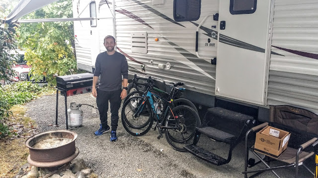
Adam preparing to make "Kalbi short ribs" for dinner...

Our ride on Sunday started out pretty much like Saturday with a 5:15 AM departure and the same route on the trail into Port Angeles.  Once we were at the PA waterfront (i.e. at “sea level”), we turned and started the climb toward Hurricane Ridge National Park and the Hurricane Ridge Visitor Center (which sat approximately 19 miles away at an altitude of 5,240’ above sea level).  As we climbed through Port Angeles, we soon came to the Deer Park Ranger Station which is considered by most folks as the beginning of the climb to the Hurricane Ridge Visitor Center.  The 5.2 mile section of the climb from this ranger station to the next one (i.e. the Heart O’ the Hills Ranger Station) is steep (7-9% mostly) and a grind – at least it was for me as I really needed a bit lower gearing.  Dwaine and Adam both had lower gearing and seemed to handle this section more easily than me.  We arrived at the Heart O’ the Hills Ranger Station at about 6:45 AM.  There was no ranger present, so we proceeded on our way without stopping (we had National Park Passes if we needed them).  The remaining 12 miles or so of the climb were less steep (more in the 5-6% range) which provided some relief from the steeper grades below but which still could wear you down due to the length of this portion.  It was foggy on the lower levels of the climb; but, as we ascended, we climbed out of the fog.  The views were probably spectacular, but we were focused on getting to the top.  A few miles from the top, Adam took off and Dwaine followed not long after.  This left me to proceed at my own pace which was fine by me.  The portion of the climb near the top can be discouraging if you are not familiar with it.  You come around a corner and see the road climbing far above you on the other side of the valley, and it’s easy to assume that when you reach that point it will be the top.  Unfortunately, this happens at least 3 or 4 times in succession before you actually arrive at the top.  It was a relief to finally see the visitor center parking lot which marked the end of the climb. 
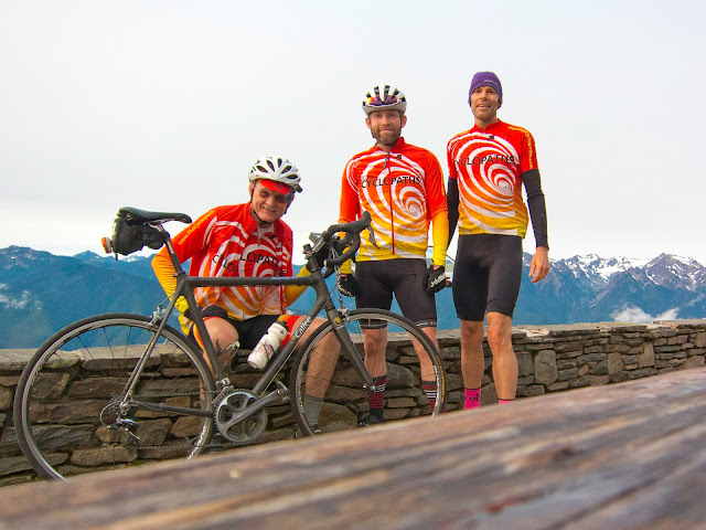
Mike, Adam, & Dwaine
Hurricane Ridge Visitor Center
(picture courtesy of Dwaine Trummert)

After a quick bathroom stop for Dwaine and Adam, we prepared for the descent (which included me getting my GoPro ready to record this portion of the ride).  I discovered that my GoPro would not record, because it thought that the memory card was full.  I knew – in fact – that the memory card had no data on it and that something was confusing the GoPro operating system.  A quick reformat of the memory card did the trick, and we were ready to record our descent.

The descent is fast (much of it between 35 and 40 mph), and the scenery is spectacular.  Unfortunately, “fast” and “sight-seeing” are not compatible, so we ignored the scenery for the sake of safety (the GoPro did capture a lot of the scenery for later viewing).  When we descend, I am often toward the back of the group as I am capturing the descent on my GoPro; and I want as many people in the video as possible.  I love sitting back there watching cyclists maneuver down a mountain road through the turns.  There are no hairpin turns on the descent from Hurricane Ridge, but there are plenty of high speed, sweeping turns.  In addition, we had done the climb very early in the morning; so there was very little traffic to contend with; and what traffic was there was easy to see at a distance.  As a result, we were often able to use the entire road (i.e. both lanes) during our descent.  Watching Dwaine and Adam gracefully sweep through turn after turn was really enjoyable (and beautiful) for me.

We were probably going around 35 mph about half way down the descent when I noticed a small rock just ahead of me.  I doubt that it would have caused a problem, but it made me reflexively “twitch” my handlebars to miss the pebble.  At 15 mph, a quick “twitch” of the handlebars is hardly noticeable.  At 35 mph, that same action caused a small – but violent – “lurch” of my bike to the left.  Luckily, it didn’t result in a problem; but it certainly refocused me on the task at hand…!! 

A bit further down the road (at about the same speed), Dwaine said something to Adam and me who were fairly close behind him.  I couldn’t understand what he said, but just after that I detected some movement by the guard rail just to our right.   A deer had been standing just off the road and had jumped the guard rail as we flew by.  I checked the video later; and, sure enough, there he was. 
Much of the last 7-8 miles of the descent was in fog that was pretty dense in places.  It caused condensation on the lenses of our glasses (and the GoPro) which hampered our vision a bit, and it made the road surface wet which made us slow down.  There are three tunnels in that section through which you pass in quick succession.  A couple of them are long enough that it is very dark and - for me at least – sort of unnerving.  I don’t like it when I’m on my bike and can’t see the road surface ahead of me.

After the tunnels, we passed the Heart O’ the Hills Ranger Station and began the final 5 mile descent toward Port Angeles.  This is the steepest portion of the Hurricane Ridge climb.  Fortunately, there was less fog here, and the road surface was pretty dry.  We flew down this section and, soon, found ourselves on the outskirts of Port Angeles.  From there, we simply retraced our steps back to the campground.

This weekend was really memorable for me.  The ride on the Olympic Discovery Trail on Saturday was so much better than I expected, and the climb (and descent) of Hurricane Ridge was special (as usual).  In addition, having the luxury of staying in Adam’s RV (which was really nice) and spending some time with Dwaine’s family was pretty cool.  Hopefully, if we do this again next year, we can get more of our group involved.

One final thought – let’s not forget those “Kalbi short ribs” that we enjoyed on Saturday evening.  They were awesome!!

Click on the following link to see the video of our descent off of Hurricane Ridge:

Wednesday, August 15, 2018

Picture Post for Hurricane Ridge Weekend Adventure -- by Dwaine

Day one of the Cyclopath Hurricane Ridge adventure weekend was the easy ride. We followed the Olympic Discovery Trail from our campground to downtown Sequim and back. The pace was moderate. There was little climbing. We had great conversations. Near the end of the day we crossed this bridge. The top deck is for motorized traffic and the bottom deck, from which this frame was captured, is reserved for pedestrians and cyclists. The Elwha river (now unimpeded) flows below.

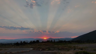
Sunday was reserved for the 'big climb'. We retraced our steps to the Port Angeles waterfront and then pointed our bikes upward. Getting through town took just a few minutes and about the time the sun came up we were climbing in earnest. When this shot was snapped the sun was just peaking over the horizon and partly shrouded in mist. The roads were damp. Our spirits were high as we climbed at a nice conversational pace. The road was nearly devoid of other travelers. Lovely.

The road to Hurricane Ridge included a few tunnels for dramatic effect. At this point in the ride the pace was manageable and the photographer fell back, snapped a few shots, and was able to close the gap. Some number of minutes later, well before the summit, the pace quickened and the camera remained pocketed.

Early in the day, before most Hurricane Ridge visitors had eaten breakfast, under the watchful eye of Eagle Point, three accomplished climbers stood near a weathered wooden picnic table and waited for the Canon self timer to earn it's keep. Click. Done.

Wednesday, August 1, 2018

RAMROD 2018: Mike Hassur's Account

Author:  Mike Hassur


I had done a lot of thinking about RAMROD 2018 before the event.  The weather forecast predicted temperatures in the 90's which suggested that this had the potential to be a grueling (or gruesome?) experience.  Given that forecast, there was no way this RAMROD was going to be about speed for me.  It was going to be about making sure that I ate and drank at a frequent and consistent rate.  For example, the first water/snack stop was Eatonville which was 36 miles from the start.  My plan was to drink both bottles by the time I had reached Eatonville and to drink at least one to two bottles between subsequent water stops (depending on the time between those stops).  Also, I planned to eat food/snacks at any stops that had food (in addition to the 16 "goo packs" that I was carrying).

Leon and I drove together to Enumclaw with the intention of meeting Les, John, and Adam at the starting line around 5:10 AM and beginning our ride around 5:15 AM.  We arrived in Enumclaw, parked at McDonald Park, unpacked our bikes and rode to Thunder Mountain Middle School to find Les, John, and Mike Smith waiting for us - but no Adam.  When 5:15 AM arrived, still no Adam.  We started the ride knowing that Adam would catch up with us.

It wasn't long before we found ourselves in a paceline consisting of the five of us plus a rider, Brian, who had travelled from Indiana to do RAMROD.  Brian had a very distinctive helmet with numerous small white lights on the front and red ones on the back.  There was no missing him. 

Our group proceeded at a brisk and comfortable pace through Buckley and South Prairie.  I believe that it was between South Prairie and Orville Road that a group moving significantly faster passed us.  Since I was in "energy conservation mode", I wasn't keen on following this faster group; but one of our group said "let's catch on" and away we went.  We were moving pretty fast and passing other groups (sometimes passing those other groups with vehicles coming behind us).  This went on until the left turn onto Oreville Road near Orting.  Leon lost control and crashed while making the left turn (his crash was due to a front tire that deflated rather suddenly).  Our   group stopped to help Leon and to wait while his tire got changed.  It was during this stop that Adam caught us.  He stopped and waited with us until Leon was ready.

After Leon's tire was repaired, our group took off again.  We stayed together past Lake Kapowsin, Lake Ohop, and into Eatonville.  In Eatonville, Leon and Mike Smith kept going while the rest of us stopped to refill water bottles and hit the bathrooms.  Les, John, Adam, and I rode together (sometimes with other groups and sometimes just our group) until we reached the food stop just east of Ashford.  After a quick stop at the food area, we were back on the road.

When we entered the national park, John and Adam went on ahead while Les and I made our way up together.  It didn't seem like we were going very fast, but we seemed to be passing a lot of people on the climb to Inspiration Point.  During that climb to Inspiration Point, I was going a little faster than I should have been.  Les and I had passed quite a few people when I realized that Les was no longer with me.  I, also, realized that I was wasting energy that I would need later in the ride.  I turned around, rode back to Les (who was only a short distance behind me), and made sure that I followed his pace the rest of the way up the climb.  In retrospect, the decision to follow Les' pace may have been the difference between me finishing the ride and me not making it.  Thanks, Les.

At Inspiration Point, we found Leon and Mike Smith.  All four of us left together and headed to Reflection Lake and down through Stevens Canyon.  The descent from Reflection Lake was uneventful though I didn't enjoy the scenery in Stevens Canyon as much as I usually do as I was intent on resting my legs and drinking fluids.

Les and I arrived at the Box Canyon food stop just ahead of Leon and Mike S.  We hit the bathrooms, gobbled down some food and refilled water bottles.  Leon and Mike S. left a little bit ahead of us, and we caught up with them just before beginning the ascent up the west side of Backbone Ridge.  At this point of the ride, Leon was having significant problems with cramping in both legs and was talking about possibly abandoning the ride.  I was certain that he was finished.  Les, Mike S. and I rode together up Backbone Ridge and down the other side.  Soon, we found ourselves beginning the climb up Cayuse Pass.  Once again, even though we didn't seem to be going very fast, we seemed to be passing a fair number of riders and not being passed.  Les and Mike S. seemed to be riding well, and I seemed to be doing okay considering the climb and the heat.  We hit the water stop located about half-way up Cayuse which was none too soon for me as I needed the bathroom.  I rushed into to "johnny on the job" and did my business only to discover - IT WAS OUT OF TOILET PAPER!!  Shit (no pun intended)!!!  I called out to Les to check the other toilet.  It had toilet paper - whew!!  We refilled our water bottles and headed up.  At the top, it was a quick fill of a water bottle and we headed toward "the deli".

I believe that this descent of the north side of Cayuse Pass is the most dangerous thing that I do in RAMROD.  We are tired and not processing information as quickly as usual after 110 miles and a ton of climbing, and we are heading off of a pass at close to 40 mph!!  I thought about this as I descended and tried to be as alert and careful as possible.  Thankfully, our descent was uneventful, and we were soon arriving at The RAMROD DELI.  This stop was not quick.  We ate sandwiches and cookies and drank V8 juice and soda.  It was much needed.  The whole time that we were at the deli, I had my eye on a group of riders in rainbow jerseys.  I'm not sure if we arrived first or if they did, but I knew they were pretty fast and would be an ideal group to follow back to Enumclaw.  As some of them moved toward their bikes, we got to our bikes and headed out.  We got on the road ahead of them and soft-pedaled for a few miles before they caught us.  We jumped in behind them, and things proceeded just as we had hoped.  They were content to rotate through their group to lead the paceline leaving us to follow along at a fast (but manageable) speed.  This arrangement could have and should have lasted all the way to the finish line, but it didn't.  A couple of miles before Greenwater, we passed two riders who forced their way into the middle of the paceline.  They, eventually, disrupted the paceline enough that the "rainbow jersey group" stopped to regroup with only their members leaving our group and the two riders who caused the problem to ride together.  While following one of those riders, Mike S. and I hit a piece of debris in the road that the leading rider failed to point out.  It caused Mike S. to blow a tire and caused us to lose probably 30 minutes.  The silver lining to this fiasco was that Leon (who had not abandoned) caught up with us. 

After Mike S. had repaired his tire, it was just the four of us all the way to the finish line.  Even though I was tired and hot, it was enjoyable doing this last portion of the ride with the other guys.  Before we knew it, we were on the Mud Mountain descent, and I knew we were almost done.  What a nice feeling.

We crossed the finish line together.  Instead of celebrating, all I wanted to do was get the van and head home.

Later, when I had a chance to think more about this ride, I realized how grueling this ride had been.  Basically, everything had gone well (except for the flat tires in our group).  I had done of good job of eating and drinking on a frequent basis, and I had no problem with cramps or bonking.  Yet, in spite of things going nearly perfectly, I was really spent at the end of this ride and had very little left to give.  In the end, I was just glad to be done.