Sunday, June 29, 2014

Etiquette Training And Adventure In The Methow Valley


Author:  Chris Fox


Etiquette:  the conduct or procedure required by good breeding or prescribed by authority to be observed in social or official life.  

 
When greeting bed and breakfast hosts in Corsica, etiquette proscribes the cyclist from kissing the proprietress on both cheeks.    On the southern island of New Zealand, etiquette suggests allowing all 
Pipestone Canyon Trailhead
cars to pass on a one-way bridge before cycling across.   And, when urban riding, etiquette recommends stopping for an elderly person preparing to step into a crosswalk.   Those are easy.    But what is the proper etiquette, when rounding a corner while barreling down a forest service road on a full suspension mountain bike in the Methow Valley on a beautiful June morning with the North Cascade mountain range in full glory on the horizon, you encounter fifteen head of cattle, herded by two horseback wranglers and a small dog, completely blocking the passage?    Such was the dilemma facing me yesterday.

The options were limited:    (1) ride on, hoping to maneuver through the huge beasts; or (2) brake hard and: (a) look for an escape route in the steep gully to the left or the steep bank to the right, (b) turn around and head back uphill, or (c) stare dumbly (like the cattle) at the developing scene of creatures scattering in all directions despite the frantic corralling attempts of the horsemen?

Primitive Road (and beginning of
"Etiquette Training Program")
If you guessed (2)(a) you would, according to the enraged wrangler, have correctly complied with his demand to “show some etiquette”.    Much to his angst, however, I chose (2)(c).    From my stationary position watching the chaotic scene I thought of a new word: entropy, defined as lack of order or predictability; gradual decline into disorder.

The circumstances couldn’t have been more contrasting:   mountain bike vs cow; cyclist vs cowpoke.   I don’t carry much weight as it is, but there was a distinct sense of the diminutive amidst the tonnage of a cattle herd and adjacent to an irate man astride a huge horse.    Etiquette demanded that I depart, downhill, rapidly, reminded of Roy Rogers:   his lyrics:  

Part of Pipestone
Canyon Loop
Happy trails to you, until we meet again.
Happy trails to you, keep smilin' until then.
Who cares about the clouds when we're together?
Just sing a song and bring the sunny weather.
Happy trails to you, 'till we meet again.
       

and the second and seventh of The Roy Rogers’ Club rules:  
Be courteous and polite, and be kind to wary of animals and take care of to avoid them”.


Addendum (from Mike Hassur):  for those of you too young to know Roy Rogers; he was a very popular radio/TV/movie cowboy in the 1940’s, 1950’s, and 1960’s.  He was sort of the “Mr. Rogers” of Westerns.

Dirty Kanza
 
Author: Brent Moody


Kansas…. Who would have ever thought or dreamed that have much elevation gain or would be any tough riding….

One of the Top 17 Bucket List rides that Leon had sent out to use this past year, it truly made the list. I had been preparing for this epic ride for a few months. Longer rides, lots of gravel grinders, but nothing can really prepare you for this ride. Dirty Kanza takes place the last weekend of May, storm season kick off in Kansas. You never know what the weather will be there at this time of year, Thunderstorms with 40 mph winds, 90 degrees and sweltering, or 30 and snow!

I had heard the previous year that the weather was 80, but 30-40mph gusts… was hoping that wouldn’t be the case. Weather was predicted with chance thunderstorms, but 85 and light wind. I will take that, especially starting out at 6am.

Of all places in the world to meet some other riders riding Dirty Kanza, I happened to be riding in Nebraska, near my hometown of Ansley, when I met a guy from Broken Bow riding the Dirty Kanza! No Way! This was a great cross of paths as we were able to get quite a few gravel rides in Nebraska a few weeks before the race. I have really taken a love for gravel grinding and the prairie of Nebraska with the desolate and minimum maintenance roads. One of these rides in Nebraska, we were outrunning the Thunderstorm and rode an extra 15 miles just to escape. The rain and hail was on our heels the entire way, LOL!
 

My wife and I had found an RV spot in Emporia, KS where the race would take place, start and finish loop. Emporia is a nice little town, but think what happens when you bring 1350 racers into town, with their support staff, etc. This little town quickly becomes overrun. What’s a really great success story about this race is it’s only about 5 years old on the spotlight. The first year started out with about 15 racers, and has grown to this size in that short amount of time. All the bike companies, etc. with even ESPN was supporting and covering this race. There was a race meeting and checking in the night before the race, very well organized, with lots of goodies. You do have to register right away when it registration comes open as it sells out within a few weeks. Race is only $90, so super in expensive and you get a lot in return from this great little town.  The racing options were a 100 mile ½ pint or the great 200 mile Fully Monty! That was me, choosing the 200 mile race. No support on the race, except every 50 miles. You have the choice of organizing your own race support, but can only meet you at the 50 mile marks. Or, the other option, what I chose, was to have 3 different bags of food, water, change of kit, and they would have them there for you at the check in spots.  Time to go home, get into bed and get some sleep.


4:30 am came very quickly the next day, but I was ready to go. I convinced my wife to get up early, give me a ride to the start line, so she could see me off. She wasn’t too thrilled about that, but once she arrived, she was pretty excited to see all the support and bikers ready to race. My goal was 12-14 hours, would be tough, but doable.  The countdown was on, and they started in waves. 12 hour wave went first, followed 15 seconds later by the next wave and so on. It was like a horse race out of the gate… Looked like everyone was out for a 25 mile time trial. I knew that wasn’t a smart move, so I stuck to my guns of holding a 17 mph pace. The weather was perfect, and no wind, some fog, so beautiful scenery and pictures. We quickly rode out of the pavement, about 2 miles and were on our way to gravel roads. Didn’t take long for some wrecks and people out of the race. I just wanted to stick to my plan, avoid the wrecks, and fuel accordingly. Looking ahead, it looked like a stampede. I could see all the riders, but the gravel dust had flared up, no wind, and really cool sunlight, looked crazy... Heck, I thought I that time, I am crazy, but excited. This flat, what I thought Kansas was, quickly turned into decent sized rollers. Grass was extremely green heading out thru these pastures, MM roads, and back roads. What was interesting was these decent gravel roads started getting pretty rocky… introduction to the Flint Hills of Kansas. I head heard some stories about this flint, sharp rocks that take no mercy on your tires. It started to look like a Nascar pitstop, guys/gals everywhere changing flats. What I noticed was though most everyone was running regular tires and tubes. I had tubeless, and what’s amazing, never had a flat or problem that day. I just wanted to keep it that way. The rolling hills and flint rock quickly took its toll on riders. Wrecks and riders gassing out already. It was carnage! I quickly passed a boatload of riders, which thanks to the Cyclopaths, had all that great climbing in!


This race had a mix of obstacles, gravel and sharp rock roads, water crossings, freeway bridges, dirt and mud, herds of cattle, herds of cyclists... you get it. I was feeling pretty good into mile 25, wasn’t riding too hard, and was fueling fine. I had been riding with a few other guys after mile 25.


 We were coming up to the first major water crossing at mile 42. This was a river… you had the choice of riding thru or picking up your bike and running. I decided to ride, piece of cake. Water was above the crank, so I would say about 2 ft. deep.


 Made it across, but muddy slick mess on the exit and steep uphill climb. I decided at this point to definitely dismount and run up the hill a bill to drier ground. I quickly jumped back on my bike and was riding with the 3 guys I had been riding with. 


WE were about at the top of the hill, jeep trail kind of road with grass in the middle and the sharp flint rock in between. The guy directly in front of me slowed down quickly and cut me off to change lanes. I quickly went down, endo’ing  myself. I laid there a bit, trying to get my sense back into me. I didn’t feel right, hands were bleeding, arm was numb, and my face didn’t feel quite right. Well, the adrenaline was flowing, so up I jumped and grabbed my bike. It didn’t look so great... Handlebars were bent; pedal bent and the big ring had a few bent teeth.  There was a couple behind me riding a tandem CX bike that stopped, luckily there were doctors. All looked good they said, so on the way I went!  It didn’t take long to set in, really didn’t feel good. My arm was pretty number all the way down to my hand.

I made it into checkpoint 50. I took a little extra time, ate some food and drank some drinks. Should have had a beer there, probably would have been much better. I re fueled, grabbed my food bag and off I went again! The next 50 miles was grueling with pain, bike not working well and I was sucking more water than usual. Found a few spectators along the way, as desolate as it was out there, to snag some water from them.  At this time, the weather was starting to get warm. I was slowing down some, but mostly because I didn’t feel well or trust my riding ability on this course. I didn’t make it to the next check point, which was about mile 96. I decided not to go on and call it a day. Mentally I was not a happy guy, but probably saved myself from going down again.

My wife ended up coming to get me and brought me back into Emporia. We did end up seeing the first finisher of the race. 10hr 42 min for 200 miles, a young kid from Kansas. Previous record was just under 12 hours. It was an amazing race, and just about 1/3 ended up finishing, so the carnage added up! I will be back next year to conquer this race!


Thursday, June 26, 2014

Seven Mile Hill Road

Author:  Dwaine Trummert
 
 
Initially I felt disappointment at having to miss  the Puyallup Cyclopath Skate Creek ride. Until I heard the post-ride weather report.

And I was happy to spend a long weekend with family in the Gorge. Hood River is a great place to windsurf, get outdoors, and relax. We did most of those.

Daddy and Daughter on the
Historic Columbia River Highway
Saturday included a family bike ride on the portion of the Historic Columbia River Highway that is closed to cars. This scenic 4.5 mile stretch of road is popular with casual cyclists and pedestrians and is a great place for younger riders. Our group started with four but my 9 year daughter upped the pace about one mile into the ride. Her and I went off the front, climbed out of the saddle, took a few photos, chatted, rested, and had some daughter-daddy time. By the end of the day my Garmin reported that we had travelled 9.9 miles with 753 feet of elevation gain. When I informed her she had completed 3/4 of the elevation gain at 'The Climb' she was especially proud.


Sunday called for a ride with a different flavor. My Father's Day plan included an alarm clock and a few more miles. Following 'The Dalles Lollipop' route from the book 'Road Riding in the Columbia River Gorge'
would provide about 50 miles and 4000 feet of climbing.

The early part of the ride included the same portion of Historic Columbia River Highway as the family ride the previous day. The real climbing starts in Mosier and ends 1600 vertical feet later halfway up Seven Mile Hill Road. The ride to Seven Mile Hill Road was nearly car free and I had yet to see another cyclist. I did witness other oddities including a wheel-sharing-triple-tandem art sculpture. Even more peculiar was a male deer. With antlers. Watching me ride by. While he sat inside a horse corral.

Although this route was a loop, the first half was primarily Eastbound with the wind aft of the beam.

Strong wind. Wind that makes Hood River and The Gorge the windsurfing Mecca of North America.

That tailwind continued down the second half of Seven Mile Hill Road. Which is a world class descent. The road wound down a series of switchback
with long straits between. The scarcity of the trees allowed me to peer over the edge, see the next stretch of pavement below, and verify that no cars were on their way up. My gearing wasn't tall enough to allow me to add any effort. Yet the Garmin flashed '45' late in the descent.

Turning left on Cheneweth Loop road started the return West to Hood River via Highway 30 (aka the Historic Columbia River Highway). But the fun didn't end. After fighting the Westerly headwind for five miles the road turned into the hills and up towards Rowena Crest viewpoint. The climb was fantastic and my arm was nearly falling off after waving to all the motorcyclists on their way down. At the top I took in the views and chatted briefly with one of the many dual sport motorcyclists that was participating in a rally and enjoying the scenery.


The ride back to Hood River was uneventful. The headwinds were somewhat mitigated by this section of highway being more protected from the wind.
And, at mile 38 of 50, I saw my first cyclist. It seems we Cyclopaths must get an earlier start than our sane counterparts.

After hearing early reports from the official Cyclopath ride participants my disappointment turned to releif. Both my ride and the Skate Creek Loop ride had weather factors. I can be content dealing with a headwind. Especially when it's a warm headwind.

Wednesday, June 25, 2014

Kim and Dad Doing 112 mi. Ride in Walla Walla


On June 20th I headed out to see my daughter Kim and to do a 100 mile ride in Walla Walla with her. Like a true Cyclopath I couldn’t resist the chance to do some riding in the Cascades on my was to Kennewick.  I decided to park at the beginning the Crystal Mt. Rd. and TT up 6.1 mi. to the resort.  The road isn’t very steep but it does gain 1650 ft. My intensity was pretty good as I tried to improve my Strava time. Only 1 car interrupted my race up the hill. When I later checked my time I was happy to see at 3 + min. improvement. I rocketed up to #2 for my age group.  I must admit I was little perplexed to find out #1 on the list (beat me by 55 sec). was a female by the name of Sheila Walsh.  She must be a heck of a rider.

After returning to the car I planned to drive to the top of Cayuse and TT to the top of Chinook.  When I arrived at the parking area I noticed the temperature had dropped to 38 deg. The wind was blowing and light rain was falling.  I reflected back on the Cyclopath ride form Paradise to Longmire a couple weeks ago and decided I would skip the segment.  Instead I drove over the pass and down 8 miles into Eastern Washington.  The sun was out and the temp had improved about 10 deg.  As I was parking 4 cyclists road by heading up the pass. It took me about 10 min. to get on my bike and by then the 4 riders were long gone but like a true Cyclopath I headed out to try to at least get within sight of them. Within about 10 min. I saw the last rider of the group and quickly caught him and with the thought of catching the front rabbit I surged on.  I made good time and with 4 miles yet to climb I caught the first rider.  Found out they were doing a 3 day ride from Portland through Yakima and back to Portland.  Realizing they were riding 90 + miles that day and I was only doing 16 tempered my enjoyment of catching them.  When I did get to the top of the pass the temperature was in the high 40’s and no rain.  YEA!!! Good choice Leon!!  I quickly returned to the car and headed to Kennewick.

Kim and I had a quiet evening together knowing we had get up early. Up at 5 we had a quick breakfast and headed out to Walla Walla and the Ann Weatherill Cycling classic.  I found out the ride is named after a 6th grade teacher who was killed while riding her bike with a group of riders by being hit by the mirror of an oncoming pickup truck that was passing another car. I was happy we were supporting a ride in her memory. The event had 3 distances 30,60, and 100 mile routes.  As Kim is preparing for her first Iron Man race we were doing the 100 mile ride. We headed out at 7:15 with the temp. around 60 deg.

My daughter Kim and I getting ready to head out on our first 100 mile ride together in Walla Walla


The ride quickly headed out onto country roads with few cars but lots of rolling wheat fields. Kim and I enjoyed the scenery and the quiet roads.  Soon the wheat fields changed to alfalfa fields in all directions. The green of the alfalfa contrasted wonderfully with the golden wheat fields.  Soon we saw huge fields of a plant similar to the alfalfa except that it had purple flowers.  We also noticed that there were 3 sided wooden huts (perhaps every 75 yards) in all directions in the fields.  We were perplexed on what that crop might be and what the huts were for.  We then noticed frequent signs asking drivers from 8 am to 8 pm drive at 15mph.  WHAT???  Well down the road the puzzle became less confusing.  Near the side of one of the roads was one of these little huts and they were filled with bees.  The bees as I now know are called leafcutter bees and are used to pollinate the alfalfa flowers to grow alfalfa seeds.  The speed limit was to prevent cars from killing the bees, which were busy at work in the fields. It has been fascinating to read about this after the ride.

The route then headed into Oregon and took us through a variety of fruit orchards. We only stopped at two of the rest stops but they were full of lots of fruit and other edibles. Eventually we headed towards the Blue Mountains (actually by our standards they were hills).  They were very beautiful with a wide range of colors (including blue).  As we approached the last 20 miles Kim asked me if I would be willing to do add 12 miles at the end so she could get to 112 (the distance on her Iron Man ride).  Sure!
 
                                               Kim and I head out towards the Blue Mts.
 

At the end of the ride we were treated to a spaghetti and meatball meal with brownies too.  I think I ate way more calories than I had burned but having ridden 112 mi. I felt I could splurge.  It was so good to get off the bike and have a wonderful meal. 

It is always great to go on a ride with my Cyclopath buddies but it is even more special to do a ride with one of my daughters.  I can’t imagine a better way to spend a day than riding with one of my family.  I was so proud of Kim riding fast and hard even though her longest ride this year had been 60 miles.

After loading up we drove out to part of the route to stop and buy a bike that was for sale at a house. It was a Trek Lexa SLX with 105 components.  It had been ridden for only 40 miles and was bought for $1,700.  We were able to purchase it for $650 for one of my other daughters.  I don’t know about you but getting a great deal is always special.

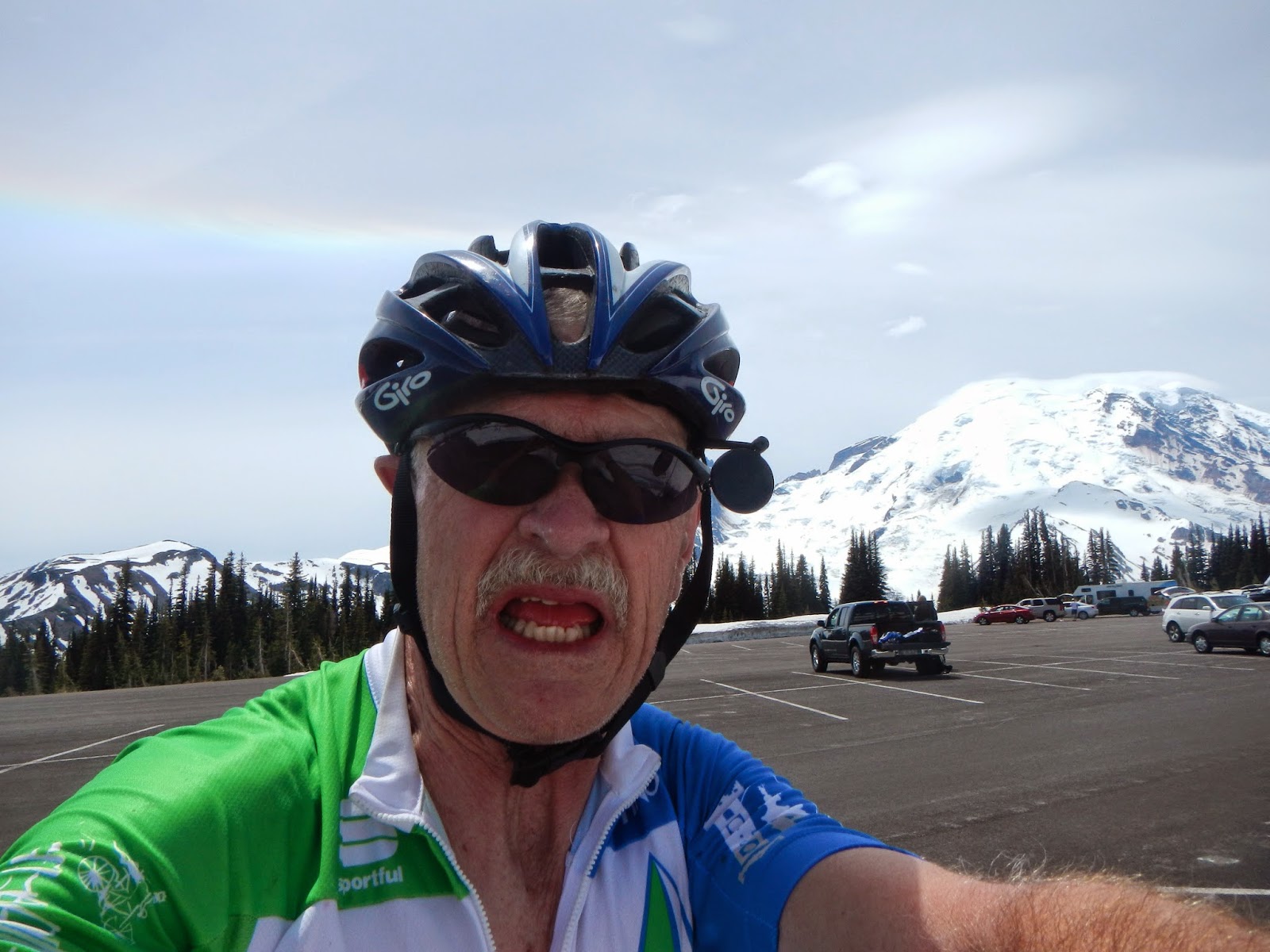
On my way back home I couldn’t resist a chance to be one of the first cyclists to ride to Sunrise this spring.  It was a glorious day with temps in the low 60s at the top. I was so happy at the top I couldn’t even close my mouth.  Not too good at doing selfies.
 

Sunday, June 22, 2014

Visiting Vashon

Author:  Chris Fox


“There are many contenders for worst hill, but Burma Road can get real ugly.
It’s so steep that you can skid if you stand or pop a wheelie if you sit.”

It’s all a matter of opinion, and perspective.  From this Cyclopath’s viewpoint, the contention is for the “best” hill on Vashon and Burma Road is, by far, totally awesome – descending and especially ascending.   Not surprising given the grade averages well into the double digits and one stretch maxes out at 28%.     Bicycleclimbs.com characterizes it as “mind bending steep.”   And, so it is! 

Vashon Island is renowned for its quiet roads, lush vegetation, beautiful views, friendly folks and hills.  

                               
If you haven’t cycled there yet, I encourage you to hop on over.  It’s only a ferry ride away.  Although you’ll only be a few miles away from urban congestion, the tranquility transports you to
Yum...
another world entirely.   But, never fear, coffee is near, including the
Coffee Roasterie and Café Luna.    

And, if the timing is right, a roadside baker may have fresh pies available for $5; the strawberry rhubarb is quite tasty.  


The roads are devilishly confusing so you may want to pull up a GPS or print a map to take along.   And when you’re done and have walked on the ferry, give your bike a hug for a fine day’s entertainment and enjoy the view – for a fare of only $5.50.

View from Vashon Ferry...


.       

Saturday, June 21, 2014

Exploring Forest Service Roads (#70 & #74) With Conor, Les, Dwaine, and Mike


Author:  Mike Hassur

 
5:30 AM:  I’m supposed to be leaving the house, but – instead I’m in my garage looking for a quart of oil.  I had checked the oil level in my van the day before while washing it and found that it was a little low.  After I had arrived home after washing the van and doing some other errands, I had forgotten to add the oil.  Usually, I keep a few extra quarts of oil in the garage, but they were gone.  A stop at the old “Jackpot” quick shop on the way to Conor Collins’ house solved my problem, and I managed to make it to Conor’s house only about 3 minutes late.  As usual, Conor was ready to go.  I added the oil while Conor loaded his bike, and we were off.

Les, Dwaine, & Conor...
Leaving Enumclaw: 
Les, cow, & Mt Rainier...
We met Les Becker and Dwaine Trummert in the parking lot of Enumclaw’s Safeway store.  The sun was out, the sky was blue, and the temperature was already in the mid to high 40’s.  Perfect weather for riding bikes in the mountains.  We headed out of Enumclaw, past Mt. Peak, and up the Mud Mountain Road Climb.  Conor took off up the climb; while Les, Dwaine, and I proceeded up at a brisk pace that allowed us to still appreciate the gorgeous views of Mt. Peak and the lowlands around it.  That climb got rid of any early morning chill that we may have been feeling.  We arrived at the intersection with Highway 410, took a right, formed a pace line, and headed toward Greenwater with Conor leading the way.  Our group of four reached an unspoken agreement almost immediately – since Conor was stronger than the rest of us, he would spend much longer periods at the front of the pace line.  In this way, he would get a good workout having to deal with the extra wind resistance; and we would get a good workout just trying to keep up with him!!  This strategy worked great on the way to Greenwater.   With Conor leading most of the way, we were passing through Greenwater in no time.

A few miles past Greenwater, we took a left on Forest Road #70.  This road will be a part of this year’s RAMROD, and Dwaine and Conor had never ridden it.  It is paved for the first ten miles back into the mountains to the east of highway 410.  It then turns to gravel, proceeds over Naches Pass, and comes out over by Whislin’ Jack’s Resort on the other side of the mountains.  RAMROD will only use the paved portion of the road, and that is what we did as well.  We encountered a surprisingly large amount of traffic on this road.  The motorists seemed to break down into three groups:  guys who were heading out to fire their guns (there are some “natural” gun ranges in the area), families who were heading out to camp for the weekend, and people towing their ATV’s out to enjoy the
End of FS Road #70...
many gravel forest service roads that honeycomb the mountains in the area.  The road has some pretty challenging climbs (up to 13-14% grade); but, thankfully, they are not very long.  After getting used to the sounds of gunfire, we made it to the end of the pavement.  We talked about bringing our cyclocross bikes up here to ride the gravel roads to Naches Pass, visited with some "snowmobile folk" who were doing some off-season work in the area, and headed back toward Highway 410.

After our “up and back” ride on Forest Service Road #70, we were back on Highway 410.  We headed south for a few miles and took a right onto Forest Service Road #74.  This is another paved road that follows a
Debris on FS Road #74...
river back into the mountains for eight miles or so.  It is now gated, so there is no traffic on this road.  This road is not ideal for riding fast as it has accumulated a lot of debris on its surface from lack of use, but it is interesting because it is so isolated and you have the road all to yourself.  The river next to the road had washed out the road surface in a couple of places which forced us to dismount and walk around those sections.  At the end of the paved section of this road, there is a bridge that connects it 
Mt Rainier looming above FS Road #74
(Click on this photo to appreciate how
large the mountain looked)...
with gravel forest service roads that run up into the mountains on the other side of the river.  When we finally made it to the bridge, we were disappointed to find that the river had eroded away the banks on both sides of the bridge.  The bridge now spans the river, but it is not connected to anything on either side!!  It had been years since I had been back in this area, and I had no idea that this bridge was out of commission.   That’s a shame, because there were a slew of cyclocross rides that I had planned on creating on the other side of that bridge.

After exploring Forest Service Road #74, it was back to Highway 410.  We rode the 23 miles or so back to Enumclaw in a pace line (with Conor leading a good portion of the time).  We rode hard; and by the time we arrived back in Enumclaw, we were tired and ready to be done (at least I was).  We had covered about 80 miles in a variety of ways: some in a fast pace line, some climbing, and some exploring (Forest Service Road #74).  After heading into Safeway for chocolate milk and other energy replacement drinks and food, we headed home. 

All done and ready for some chocolate milk...
 
Perfect weather, great group, and the mountains = awesome ride.  Can’t wait for the next one!!

Sunday, June 15, 2014

The Skate Creed Loop Ride - Sort Of... (Part 2: The Les Becker Version)


Author:  Les Becker


The Saturday, June 14th, weather forecast for Ashford was 45-55 deg and zero chance of rain in the morning. And indeed we started riding on dry pavement with temperature in the upper 40's. With plenty of riders for friendly conversation and enough warmth pedaling uphill, I did not focus on some subtle but important changes taking place. A heavy mist developed under the overcast sky and on the upper part of the climb I felt a chill and was surprised to see 38 deg on my Garmin, but dismissed it, thinking things would warm up once we descended Stevens Canyon. Standing in the Paradise parking lot with Leon and Mark, I felt cold and wet,  I realized I had to get serious about getting down safely. Scott Wagar's Garmin said 33 degrees, so I started down clad in just my base layer and short sleeve jersey under my non-waterproof jacket, shins exposed under knee warmers and summer cycling gloves with fingers exposed.  My rear brake had developed a metallic grinding sound I assumed was grit embedded in the brake pads which together with the rain, made me question the braking effectiveness. So I stopped, took off the back wheel and scraped the pads with my car key. That was the last time I could feel my fingers for some time. I continued down and shortly found Mike at the side of the road as he'd circled back to check on other riders. When I told him, "I've got to ride back to the cars, I was relieved that he quickly replied "so are we." As I headed down, my bike was quivering not due to speed or bumpy roads, but from my whole body shaking. And of course, I couldn't feel anything in my bare hands. Shifting required me to look at the lever to see if it was moving. At the Ricksecker Point turn-off I stopped, and was joined by the others. Even jumping jacks and hands in armpits (mine) did not warm me. Jim was very attentive and pushed some plastic under my jersey for a wind break. Then an angel from heaven showed up in the form of Peter, his wife and two children who were vacationing from Arizona and saw us standing there shivering so they pulled over. Over my objection, they and Jim put me in the car and bike in the back. Forgive me if I have ever said anything bad about seat heaters. And get this, he is an ex cat 1 racer who used to own a bike shop. And it didn't hurt that he is now a paramedic and she is a nurse. They were so kind and their two kids so sweet with this cold, wet, shivering stranger plopped into their car. They dropped me off at Longmire Lodge. I thought I was way ahead of the others who had to brave the entire descent on their bikes, and I was surprised when Conor immediately rolled up.  On second thought, why should I have been surprised?  We all gathered in a room adjacent to the lobby and after stoking the fire in the large stone fireplace, drinking hot chocolate purchased by Jim, wringing out soaked socks and hanging them on the fireplace screen, and much laughing, the shivering decreased and we began to feel better.

 Awards:

Best prepared - Nick had full gloves, couple coats, long tights, full shoe covers and I don't know what all else, next time I'll be more like him.

Humanitarian - Jim kept me out of trouble with wind protector, putting me in the car, and the hot chocolate.

Innovation - I think it was Mark who found the gift shop and started the dry sock purchases.

Persistence - Scott must have continued right past the Lodge without stopping on his way to the cars.

Leader - Thanks Mike for being aware of everyone's location and condition and ensuring wise group decisions.

Lesson learned:
Watch the temperature on Garmin and be aware of the rain, duh.

Saturday, June 14, 2014

The Skate Creek Loop Ride - Sort Of...

Author:  Chris Fox
 
 
Rolling out, with great expectations
for an 80 mile morning ...
It may not have registered on a Richter’s Scale, but there was a whole lot of shaking going on today as thinly clad cyclists with minimal body fat manifested the initial symptoms of hypothermia on the western road of Mount Rainier National Park.   It certainly wasn’t the expectation of  twelve Cyclopaths to etch such memories as they set out early Saturday morning for the annual “Skate Creek Loop”, an 80 mile ride through the beautiful forested and alpine setting.  
 
Entering the Park:  note the dry road...
The opening miles were marked by easy pedaling and stimulating conversations.    Then the 3,700 foot climb began to Paradise Lodge 18 miles ahead.     Conor and new arrival, Mario, took the lead while the remainder of us settled into a steady cadence.   Ominously, elevation and precipitation rose in inverse proportion to descending fog and temperature.    Mount Rainier was not to be seen.    After a few miles we passed Longmire Inn:   2,761 feet, another 11 miles and 2,700 feet to the Lodge.    Except for an occasional car we were alone on the roadway, the hour and the weather deterring many park visitors.    The rushing waters of the Nisqually River provided a background symphony.  
 
At the two hour mark four of us joined Connor and Mario at the Lodge.    While Jim went in search of hot chocolate, I found the men’s room where warm water brought life back to my fingers but the hand dryer had little effect on my wet socks.       
 
After a few minutes we decided to reunite with the others and check on their condition.   Leaving the warmth of the lodge a park ranger kindly warned the road might be dangerous and cautioned us to be careful out there; prescient words, indeed.    It took just a few turns of the pedals into the blowing drizzle to concede the 80 mile loop had to be dramatically shortened.   
 
While the ascent had been rather methodical, the descent was downright maniacal.   Chilled to the bone and lacking feeling in the extremities, maintaining control on the patchwork asphalt was quite challenging.   I found myself losing control of the bike as my shivering limbs transferred instability to the frame.    Tucking my knees to the tubing didn’t help.   The only answer, but not solution, was to dismount and begin running around, flapping my arms in a bizarre circulation inducing callisthenic.    Passing motorists, cozy and warm, probably thought it a tourist attraction; perhaps a comedian pantomiming an ancient Cascadian ritual.       
 
Further down the road we met the remainder of our group huddled around Les who was experiencing more serious symptoms.  Apparently he had taken his cycling reputation as the “Silent Assassin” to a new level by forming ice in his veins.  Fortunately, a car with good Samaritans 
David taking Les' place on "fire duty"...
stopped.  The driver - a paramedic/bike owner/former Category One racer - and his wife - a nurse - gladly transported Les (and his bike) to the Longmire Inn where the rest of us later found him by the warming fire.  Actually, he was behind the screen, appearing to be crawling into the fire.    Were we witnessing extreme measures to rekindle circulation?  No, he assured us, only adding wood to the flames.   We all huddled round him, sharing stories as we wrung water from our clothing and moderated our shaking.
 
Warming slowly...
Irrepressible Jim prerparing to "turn up the heat"...
In his book, An Ascent of Mount Rainier, John Muir wrote of his indebtedness to Mr. Longmire in 1888.    One hundred twenty-six years later similar sentiments of gratitude are extended  to the Longmire staff for the hospitality they provided to this group of cyclists who, finally, had sense to come in out of the rain.  
 
Conor, dry t-shirt and socks... and look at those shoes!!!
The “Skate Creek Loop” of 2014 was truly an epic adventure!    One the Cyclopaths will long remember for its drama and camaraderie.  

To see all of the photos associated with this ride, click on the following link:  https://plus.google.com/photos/103821724300588557330/albums/6025206284205650817?banner=pwa .

Monday, June 9, 2014

Gabe Scott In The News

Cyclist trims down, revs up for benefit ride

A slimmed down Gabe Scott has taken up bicycling. Scott, a Mike Scarff Subaru sales and leasing consultant, plans to join Team Subaru in a 100-mile charity bike ride to benefit the American Diabetes Association. The Tour De Cure race is July 26 in Hillsboro, Ore. - Courtesy photo
A slimmed down Gabe Scott has taken up bicycling. Scott, a Mike Scarff Subaru sales and leasing consultant, plans to join Team Subaru in a 100-mile charity bike ride to benefit the American Diabetes Association. The Tour De Cure race is July 26 in Hillsboro, Ore.
— image credit: Courtesy photo

From Auburn-Reporter.com
Jun 9, 2014 at 10:00AM updated Jun 10, 2014 at 12:57PM

Gabe Scott, a Mike Scarff Subaru sales and leasing consultant, will join Team Subaru in a 100-mile charity bike ride to benefit the American Diabetes Association this summer.

The Tour De Cure race in Hillsboro, Ore., on July 26 will be the first event of its kind for Scott.
"Live to ride ... ride to live," a determined Scott said of his goal.

Scott took up cycling two years ago as a 275-pound man after a friend successfully lost weight by getting on a bike. Scott soon became addicted to the sport, losing 40 pounds as a result of his new exercise regime.

Prior to discovering cycling, Scott frequently went to the gym and used elliptical or stationary bikes but grew bored with the monotony of indoor exercising machines. With outdoor cycling, Scott discovered it was possible to enjoy exercise.

As a single father, squeezing in training rides to prepare for the race has been difficult for Scott, but he plans to increase his mileage over the next six weeks to prepare for the benefit ride.

Scott trains as a member of the hill-loving Cyclopaths cycling club in Puyallup. Part of Scott's training includes riding a low-traveled road known by the club as "The Climb," which ascends 1,000 feet in five miles.

Until now, the farthest and most challenging ride Scott has done was a treacherous 103-mile event in Chelan that featured approximately 8,000 feet of climbing. If his schedule allows, Scott hopes to complete this route again in late June as part of his training.

The Tour De Cure race offers multiple distances for all levels of cyclists.

To sponsor Scott in the upcoming race, supporters can visit his fundraising page. Scott has a fundraising goal of $2,500.

To learn more, contact Scott at 253-737-1345 or gscott@mikescarffsubaru.com.

Sunday, June 8, 2014

New Mexico and Moab!


By: Brent Moody
 
Starting to get hot in Arizona, so off to the higher elevation in New Mexico and Utah. I was really looking forward to getting some higher elevation rides in.

Cloudcroft, NM

Top of Cloudcroft, NM
This was on my bucket list… Big climb in only 19 miles, about 4500 feet! I started early in the am, as the wind was supposed to come up around noon time. I know I wanted to at least beat the wind going up the mountain, but I could handle it coming down. I ended up getting about 5 miles of warm up before the road quickly took a turn UP. The great thing about New Mexico is the shoulders are pretty wide. The ride up doesn’t give you many breaks, so no relaxing, but great views all the way. You go from white sands desert to a ski resort in just 19 miles. Beautiful ride up to the top, but never saw another cyclist.. could have been since it was a weekday. Definitely put this on your bucket list if you’re down in the southern New Mexico area. This fall, I’m going to take the back way up with is all gravel road, about 27 miles and a little more climbing. I reached the top feeling pretty good. I took a small rest and new I had to beat feet back down the mountain. Sure enough, wind came up strong! It about blew me off the road a few times, and pedaling down the mountain not as fun into the wind.


The Next ride was set to leave from Alamogordo and follow the “Billy The Kid Trail,” thru Ruidoso an onto Lincoln, NM. I was planning on about a 100 mile ride, which the loop out of Ruidoso to Lincoln and back would reach that mileage. I felt like an outlaw that day, just imagining and laughing of what people would think if I had “six shooters” on my side while pedaling a bike, LOL! This was a great climb for 50 miles, and the weather was perfect, no wind. I had to stop at one of the coolest looking churches I’ve seen
St. Josephs Church Mescalero, NM
St Josephs Church Doors, very cool
 

Once you arrive in Ruidoso, it’s a winding road, and up you go again. Cool area out there as I could imagine some of the deep canyons around there would be great hideouts for Billy the Kid. Wind came up as usual after

12 noon. I think I had some times of 30-40 mph gusts, tough rest of the ride, but worth it! Never saw another cyclist again.. Hopefully I haven’t scared them off. 
               
 
Billy The Kid Trail Blazers Mill historic site


Santa Fe, NM
Ride up Hyde Park Road
I was really looking forward to this little gem. We were only there about a week, so had to cram a few rides in and check out the area. WOW, all I can say. Amazing cycling, Amazing food and drinks, amazing art galleries. I took off the first day and road up thru Canyon Rd, which is full of art galleries and eateries. This is Old town Santa Fe, so a must to ride and dine at if you’re visiting. I really wanted some climbing today, so the starting point was at 7700 ft. I knew I was in for a long day.. The route I was looking at was up to the ski resort above Santa Fe, which had an elevation above 11,000.
Snow!
 
Half way point to the top of Hyde Park


I did finally see some cyclists, A LOT! It was a beautiful am, no wind, temps in mid 60’s. It was a climb right out of the gate, so only had a 2 mile warm up. Once I was above Santa Fe, I battled a few flats within a couple of miles, but finally cleared that up. At least it was on my mind as I was out of Co2 cartridges and tubes. You quickly ascend out of the homes and desert into the tree line of pines and aspens. This was pretty close to heaven, clear and no noise, only me and the bike. Again, no breaks at all on the climbing and was quickly in the snow level. I started getting a little worried, on top of no tubes or Co2, that a storm was approaching. All I know is in the mountains in the spring; it can quickly turn to snow. I kept grinding determined to get to the top and see all of Santa Fe below. Most of the cyclist turned around below me, so all by myself! 

Near the Top of Hyde Park
 

Great trails and mtn biking around, so if you’re into that, another must go to place! This road kept bending and climbing just when you thought you might be on a plateau, so the road is tricky. I finally made it up to the top in a few hours, took a small rest, and was a quick descent. Make sure to visit the square downtown Santa Fe and hear the church bells ring.
MOAB!
Jim Riding up 11%
Moab is a place that is the vacation land of every cyclist. You can road bike, CX bike and mountain bike here. It’s all about the outdoors, so in between rides, you can also get some Jeep tours in, skydiving, river rafting, or just post riding beer drinking in. Make sure you book well in advance before coming here, as it’s pretty packed all the time. I think I saw more cyclist in one day here than I had seen all year, lol. One of my friends from Denver brought his triathlon team over for a 4 day weekend, almost 100 of them! Another good friend and his wife from Ft. Collins were coming over to meet my wife and I, so was really looking forward to riding with them here.
First morning ride after we thought we would tackle the Dead Horse State Park ride, about 70 miles and some climbing. Lots of sun here, but always plan for the wind.. The canyons around Moab, wind is always swirling, so Murphy’s Law, wind always in your face.  Some great climbing, 11%grades, switchbacks, and taking turns blocking the wind.                          
Bethany riding up 11%
                                                                                                
One thing about this state park, it’s on the edge of the canyon, and the final mile to the edge of the cliffs is only about 50 feet wide and 3000 feet down.. As I was riding across what seemed to be a single track, my legs and knees were shaking. The story goes that this is the place the cowboys or Indians drove the wild horses here so they could not escape. The mere 50 feet wide spot was an easy place to put a fence up. Some of the horse went off the cliff or died of starvation here.   We took a little a little break and took some amazing shots. Just the mere short rock walls that separated us from the drop made me a little uncomfortable, LOL. There were people there who crawled over the way and was sitting on the very edge of the cliff...not the smartest.
 
Jim and I at top of Dead horse
 
Breathtaking views looking down from Dead horse State Park. Check out the Jeep trails below


This was only the half-way point, so all the way back was for sure head wind. Tough ride, but breathtaking! WE took a day off, and then the next day was planning a ride up thru The Arches. Another amazing ride you have to put on your bucket list.
 
(Jim riding up Arches climb)


(Balanced Rock in the back ground behind me!)


 This was such a great ride, about 75 miles out and back and 4500 feet of elevation.


We decided to heck with the day off the next day and tackled the mountain bike. Jim and I both didn’t have a lot of time on the mountain bike, so we knew we wouldn’t get far. I really forgot how tough mountain biking was, kudos to you mountain bikers! WE had a great time though, a few flats, and had to walk as well since didn’t have enough tubes. The “whole enchilada” is the famous ride in Moab. WE watched a video only of a guy that had his go pro…Whoa!! Can you imagine single track about 3 ft wide in spaces at 8,000 feet? Each side was a sheer cliff of 2000-3000 ft. down. I was scared and nauseous just watching the video! Someday I will get enough nerve to tackle that!

 
Last few days were dedicated to my honey, since she doesn’t ride bikes. We ended up hiking a bunch and had some killer views in. Breathtaking at the least I can say. Each city we arrive at keeps topping the list. How do you top Moab? There are over 2000 arches around Moab, so go cycle or hike it while you can, it won’t be there forever. All this is sandstone, so formed by water. Landscape Arch, the most famous arch, had a big piece break from it a few years ago. Its days are numbered, so get up there!
Jen under Windows Arch
Me at Landscape Arch


Panoramic View of Dead Horse State Park


There are so many pics I could post; I just can’t explain the true beauty and breathtaking rides in Moab. Anytime anyone wants to ride there, call me, I will come meet you!
 
Next Blog coming up is Colorado/Nebraska and then Dirty Kanza Ride in Kansas. Waiting on pictures from Dirty Kanza.