The plan was to meet Dwaine in the parking lot of the Parkland McDonalds at 5:30 AM, leave his truck there and drive to the starting point for our ride together. Some stern looking signs about having your vehicle towed in the McDonalds parking lot convinced us that leaving Dwaine's truck at a Park-n-Ride located at the "Roy Y" might be more suitable.
Our drive to Ashford was uneventful; and we were pulling into our usual little, gravel parking area where the ride begins at around 6:30 AM - ONLY TO FIND "NO PARKING" SIGNS HAD BEEN POSTED THERE. After a short discussion, we decided to simply park along the small, nondescript road that was just on the other side of the intersection from our usual parking area.
Soon, the rest of our group began to arrive; and we were on the road heading toward Mt. Rainier's Nisqually Entrance shortly after 7:00 AM. We had eleven riders (Lanny, Mike R, Rob C, Dwaine, Nick I, Nick M, Scott, Martin, John, Rob D and Mike H) and were soon joined by another rider (Adam, who had arrived early and had already ridden up to Paradise and back down once). Adam was unable to do the full ride with us due to his son's soccer game, so he figured to get "his money's worth" by riding up to Paradise twice - once early and once with the group.
In previous years, we were on the road by 6:30 AM which meant that the Park Rangers were not manning the toll booths at the park entrance that early. This year - since we had a later start - the Rangers were there waiting for us. We whipped out our National Park Passes and met two of the nicest Park Rangers that we have encountered at the park (no offense intended to the other Rangers).
After that, we headed up toward Kautz Creek, Longmire, Narada Falls and - ultimately - Paradise.
 |
| John and Rob D nearing Narada Falls... |
 |
| This view of Mt Rainier as we near Paradise is so spectacular... |
 |
| Dwaine and Scott attempting to make an "L" with their right hands to honor Les and Leon who couldn't make this ride... |
 |
| Mike H (photographer) not shown... |
After a quick stop at Paradise for photos, food, liquids and bathroom; we retraced our path back down to the cutoff road which would take us past Inspiration Point and on over to Reflection Lake. Inspiration Point really does live up to its name on a clear day. Check out these photos from there:
 |
| Unfortunately, this photo does not capture the beauty of Narada Falls as seen from Inspiration Point... |
It is only about a mile from Inspiration Point over to Reflection Lake where we "regrouped" (a few of the guys had elected to take the cutoff road directly to Reflection Lake instead of going on up to Paradise). We had discussed this before the ride and had arranged that we would regroup at the lake before heading down together on the descent through Stevens Canyon.
After Reflection Lake, our route took us down the long, fast descent through Stevens Canyon on the east side of Mt. Rainier. As you descend through Stevens Canyon; you have a cliff on the right side of the road, a rock face on the left side of the road, the road is rough and you are going fast - it really makes you pay attention. After Stevens Canyon, we passed by Box Canyon and, then, started the three mile climb up Backbone Ridge. On a clear day, the views from the top of Backbone Ridge are pretty memorable:
We crested Backbone Ridge and headed down it's east side to Grove of the Patriarchs where there were bathrooms and water to fill our water bottles.
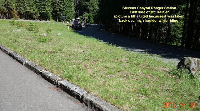
Once you leave Grove of the Patriarchs; you pass the Ranger Station on the east side of the mountain, turn right onto Highway 123 and descend 4-5 miles to Highway 12. Turn left on Hwy 12 and you are headed toward White Pass... turn right on Hwy 12 and you are headed to Packwood... we turned right. The ride on Hwy 12 to Packwood gradually descends over rolling hills for about 8 miles. It, invariably, turns into a pace-line that is going fast. This year's ride was no exception... it was really fun!!
There is a general store in Packwood where we can refill our water bottles and get something to eat to help us prepare for the last leg of the ride - the 24 miles back to our vehicles which includes a 14 mile, gradual climb up Skate Creek Road.
The climb up Skate Creek Road is not steep; but you are tired by this time in the ride, it is a long climb and it is difficult to determine when you have reached to top of the climb. Most of us have had the experience of thinking we were done with the climb only to find that we had a couple of more miles to go - ugh. Fortunately, this year's climb up Skate Creek Road went well; which left us with 9 miles or so of descending back to our vehicles.
Other than our initial difficulties with parking, this ride turned out to be a great one - the weather was perfect, and we had a great group of riders.
To see all of the photos associated with this ride, click on the following link:


No comments:
Post a Comment