Saturday, June 6, 2015

2015_06_06 Puyallup Cyclopath "Skate Creek Loop" Ride

Author:  Leon Matz


Our 2015 Puyallup Cyclopath Skate Creek Loop Ride was an unusual and eventful ride.  At a ½ hour out of Puyallup, Dr. Nick, Conor and I get a call from John Winter saying that he had overslept and would join us, hopefully, at Reflection Lake.  When we arrived at the ride’s starting point, there were already 5-6 cars there.  We all started greeting each other and getting ready for the ride.  Within a minute Dr. Nick shares that he forgot his food for the ride.  A moment later he then shares he left his cycling shoes also. Heck!  Not to be detoured Nick got ready and took off with the shoes he had worn to the ride. Shortly thereafter, Mark took off.

The remaining 12 people pulled together for a few last instructions and requests. One of the instructions was to regroup at Reflection Lake. Slower climbers were encouraged to take the cutoff road and save 2+ miles of climbing to Paradise.  John still had not arrived, and Rod and Chris were not yet there either.  With Conor, Craig, Mario, Lanny and a few others leading the group the pace from the start was pretty quick. Memories of us slowly riding and talking as we headed towards the park hit me.  “I know Les needs to make it to this afternoon’s wedding on time, but we don’t need to go this fast”!   Prior to Longmire, we caught Nick. I slowed to see how he was doing without his cycling shoes and found out he had not taken any food from the other riders.  I gave him a bar and wished him good luck. In this short time, I found myself a couple of hundred yards back from the group.  It was not an easy catch for me.  It took about 5 minutes and harder riding than I would have liked to have done especially so early in the ride to catch up.  We found ourselves at Longmire in less than 40 minutes.  A few riders started getting dropped from the lead group.  A little farther up the road, we caught Mark; and a little later we caught up to Tom who had started early to take it easy on his injured knee.

Heading up to Paradise (literally)...

Soon, Mario shot off the front and the pace sped up. Soon the lead group was rather small. Conor Dewayne, Les, Lanny, and Scott W. pursued Mario; and Tom, Eric and I followed. Soon the lead group was out of sight and the only riders Tom and I could see was Les and Scott.  I arrived at Paradise in 1 hour and 49 minutes from the time that we started.  The typical time to Paradise on this ride was 2:06. I told Les that after a short rest they should all head down the 1 way road and head to Reflection Lake.  I headed down the two way road. Soon Eric was sighted and he continued up.  I then found Mark and Bram Dally. Bram shared that he was going to go to Paradise, wait for Nick, and they were going to go back to the cars and end the ride there. Mark turned with me and headed down to the turnoff and headed to Reflection Lake.  

Part of our group at Reflection Lake...

Upon arriving we discovered NO ONE WAS THERE! Where were Martin and Craig???? We waited about 5 min and just as I was going to ride back the other Cyclopaths arrived including John.  Martin and Craig must have kept riding.  Keeping a group of 15 riders together is a challenge.  The ride down Stevens Canyon was fun and quick.

Heading into the hairpin turn just above Steven's Canyon...


On the way Conor shared that, instead of going with us around to Packwood, he wanted to do more climbing.  At the bottom of Stevens Canyon, he headed back up Stevens Canyon with the plan to see us somewhere on Skate Creek Road.  At the top of Backbone ridge, we caught up with Craig and Martin.  After re-grouping, we headed down and exited the park. We did a single line pace line along HWY 123.  It was real strange rolling back 12 bikes to get to the end of the line. When we hit HWY 12, I requested we try to do a double line pace line.  At times we were somewhat proficient and others times not.  It was fun to try!  With a smaller group and a steadier incline or decline, it would have been easier.  During this section Chris and Rod caught us and passed us. Chris commented that he “Needed to pee”.   One thing for sure the rotating pace line caused most of us to focus on the rotation and as a result the time went by quickly.

We all stopped at the gas station in Packwood, ate some food, replenished our water bottles, and took some clothing off.  The sun was warming us up; and - with the Skate Creek Climb ahead of us - the amount of clothing would be limited. 

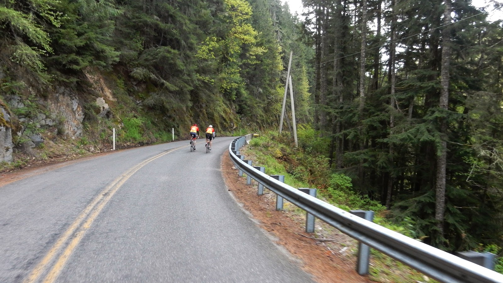
Soon, Mark and Martin took off to get a head start.  Shortly thereafter, the rest of us headed out.  The pace for the first few miles was quick but not too crazy.  Before long, Mario took off; and Lanny and Scott took off after him.  I had hoped we would stay together longer, but it became evident the race to the top was on. Even though Mario was already out of sight, a number of us increased our tempo. Pretty soon John and I were on the front of the group driving the pace.  After about 5 minutes, I checked my mirror and was surprised to see the group starting to drift back.  John and I started working together and soon saw Lanny up the road a little ways.  On one long straight away, we caught a glimpse of Mario. I was pretty sure that John and I could not catch Mario unless we could add a third person.  As we started to catch Lanny, I was hopeful he could share the workload with us.  As we passed him, I asked him to jump on; but, after a minute or so, I saw him dropping back.  We seemed to be making some progress cutting into Mario’s lead but not very fast.  I started accepting that Mario would not be caught when I noticed a rider catching us from behind.  It must be someone real fit, because I am giving it all I can and they are catching us pretty quickly.  That fit guy was Dwaine (no real surprise).  He quickly caught us and joined into the effort.  Dwaine’s strength and positive attitude gave all three of us hope that we could catch Mario.  The climb up Skate Creek is not very steep and is beautifully shaded.  Because of the mild pitch, we were climbing at 12-15 mph not the 6-9 MPH like is typical. One difficult thing about the climb is that it is really hard to predict how close to the top you are.  Numerous times I thought we were getting close to the top only to be fooled.  About a ½ mile from the top, the three of us caught Mario; and we all finished together.  Mario, Dwaine, and John continued on as I turned around to check on the other riders.  Not too far behind were Les and Tom. I passed the rest of the riders until I came upon Martin and Mark and I road with them to the top of the climb and then back to the cars. We had fun talking and enjoying the thoughts of a challenging and beautiful ride.  When we arrived at the cars everyone was sitting around talking and packing things up. 

We had ridden so fast as a group that Les had plenty of time to make it to the wedding. We had covered just under 80 miles and 7,000 feet of climbing.  A good day’s workout!

Some of us decided to drive to Eatonville and stop at Subway to continue our conversations about what a wonderful ride we had. To me it was a great way to finish the ride.


To see all of the photos associated with this ride, click on the following link: https://picasaweb.google.com/103821724300588557330/2015_06_06SkateCreekLoopRide?noredirect=1#slideshow/6160790468473045122


Saturday, May 30, 2015

2015_05_31 Backbone Ridge (east side), Paradise, Backbone Ridge (west side), Cayuse Pass, and Chinook Pass Ride

Author:  Mike Hassur


** NOTE:  TO VIEW AN ENLARGEMENT OF ANY OF THE BLOG'S PHOTOS, SIMPLY CLICK ON THE PHOTO.  TO RETURN TO THE BLOG, CLICK ON THE "X" IN THE UPPER RIGHT HAND CORNER OF THE PHOTO **

Les Becker came by my office last week (we work in the same clinic) and asked if I was available to ride this weekend.  I said “sure, let’s head to the mountains”.  We decided to park at The Steven’s Canyon Entrance to Mt Rainier and head up toward Paradise.  If we had any energy left when we returned to the vehicles, we thought that we might consider Cayuse Pass as well.  I called Leon Matz to see if he was interested in going - he was.  I, then, sent out an email to the Cyclopaths (and friends) to see if anyone else was interested in joining us – and go no takers??!!  I talked to Les on Friday evening, and he told me that Dwaine Trummert was coming as well.  Great – Leon, Les, Dwaine, and I would have a good time together.

Leon and I left in my van about 4:45 AM on Saturday morning.  By this time, we had received word from Mark Delrosario that he and Kurt Maute would be joining us as well.  The weather was spectacular (early AM temps in the 50’s, clear, and sunny), and we were psyched.  When we arrived at our destination, we found Scott Wagar and Kevin Vilhauer waiting for us as well – awesome!!


We unloaded our bikes and were soon on our way up the east side of Backbone Ridge.  Backbone Ridge is a nice way to start.  It’s not particularly steep, so you can sort of cruise along and visit with each other on the way to the top.  The vista from Backbone Ridge is breathtaking, and today was no exception.


We were soon zooming down the west side of Backbone Ridge, past Box Canyon, and into the lower section of Steven’s Canyon.  Mt Rainier has many spectacular areas, and it’s probably not fair to single out an area as the most scenic; but Steven’s Canyon is certainly one of my favorites.  The road cuts across the face of the canyon wall all of the way up, so you have a sheer rock face to your right and a drop off too your left as you ascend.  The views are amazing and the descent on the way back down is… EXCITING…


After climbing through the Steven’s Canyon area, we proceeded up past Louise Lake and on to Reflection Lake.  After taking the traditional photo of our group by Reflection Lake (with Mt. Rainier in the background), we headed toward the final short climb to Paradise).


We stayed at Paradise just long enough to take in some food and liquids and refill our water bottles.  From there we retraced our steps back down past Reflection Lake, Louise Lake, the descent through Steven’s Canyon, back up the west side of Backbone Ridge, and the final descent back to our cars.  We didn’t take many photos on this part of the ride (going too fast) though we did manage one atop Backbone Ridge (it is always so spectacular).


After refilling our water bottles and restocking our food supplies at the vehicles, we bid Mark and Kurt farewell (they had to get home) and headed up Cayuse Pass.  About half way up, Scott and Kevin turned around and headed for their cars and home.  That left Leon, Les, Dwaine, and me (Mike).  At the top of Cayuse Pass, Leon left us – his goal being to ride his bike all the way home.  Les, Dwaine, and I headed on up to Chinook Pass.  The weather and riding conditions couldn’t have been better, but I was pretty happy to see Chinook Pass (I was getting tired). 


From Chinook Pass, it was – literally – almost all downhill back to our cars.  It was thrilling (speeds over 40 mph some of the time); and, at the same time, it was a little stressful (the descent required full concentration and focus which was difficult after 70 miles of riding in the mountains).  We made it back to the cars in one piece and with smiles on our faces.


Pretty awesome for an “impromptu” ride!!  Can’t wait for the next one…


To see all of the photos associated with this ride, click on the following link:  2015_05_31 Backbone Ridge (east side), Paradise, Backbone Ridge (west side), Cayuse Pass, and Chinook Pass Ride

Sunday, May 24, 2015

LEON'S EAST COAST ADVENTURE - DAYS 4 & 5 (5/23/2015 - 5/24/2015): CLIMBING THE LAST OF THE "100 TOUGHEST CLIMBS" AND RACING IN TORONTO

Author:  Leon Matz


Day 4:                After climbing for three days in a row and then driving to Toronto area I needed a rest day.  I wish I had 3 days but travel plans would prevent that. I mostly stayed around my hotel room and wrote up some of my blog posts. A Toronto friend that I met when I raced in Italy in 2013 took me and a friend to drive the ride route to get a feel for it. In 54 miles, it gains 4,400 feet so lots of rollers and some 12-15% pitches.  Unfortunately, pretty heavy wind was forecasted and ½ the course was fairly new chip seal. Not so new that there was lots of loose gravel, but new enough that there were no smooth patches to ride on.  Not sure why, but the older I get the more my distaste for chip seal grows.  

Day 5:                As most of you know, I am a morning person.  It was real strange waiting until 1 p.m. to race. After a nice breakfast, I did some reading and again worked on some of my blog posts. About noon I headed up to Blue Mountain which is the ski resort just outside Collingwood, Ontario where the race was to start.  In the parking lot, I ran into Mark McCarthy, a guy I had raced against in Italy. He is a terrific climber and - in fact - holds the record for my age group climbing up Mt. Washington.  He did it in 1:13.41 and beat the old record of 1:20.08. To give you some perspective, the fastest guy of any age group last year was a guy from Denmark who went up in 52:53. My time the other day was 1:43. Needless to say he is real fit and real fast. I went out for a short ride to warm up my legs and my heart to the hard work that was ahead of me.  

I decided to ride the race with one large bottle and remove my second cage and carry one small water bottle in my back pocket. In the first 5 miles, I was with the main group and doing fine. Soon I noticed my bottle almost jumping out of the cage and then realized one of the bolts had come out. I salvaged the bottle and put it in one of my back pockets. Soon the other bolt came out and my bottle cage went flying to the road.  At about mi 10, I was dropped by the main group. That was very disheartening since I knew my pace would slow with no one to help break the wind for me. I also knew that I would never see the main group again. My only hope was that others in my age group would not be able to keep the pace and I could catch them. For the next 20 miles I road by myself and struggled with the head winds and the chip sealed roads. I tried to not be discouraged and lowered my effort by focusing on keeping my heart rate just below lactate threshold. Eventually, I was caught by some women that had started 5 min. after the 50-65 men.  I finally found a gal who was about my speed, and we started to work together. We stayed together for the next 18 miles. With about 6 miles, left she started to slow; and I could see some single riders ahead of me.  I left her to pursue them.  I caught and passed 6 more riders.  Several of the riders commented about "where did you come from?" I felt real strong and probably could have caught some more riders if the race had been longer than the 54 miles. Endurance has always been one of my strengths. I finished with a 17.5 mph average which I thought was pretty good considering 4,400 ft of climbing, riding alone in the wind, and chip seal for much of the ride. I felt good about how I finished, but 6th of 7 riders in my age group will not get me to Amateur Worlds. Strangely, I beat a number of riders in the age groups below mine.

The quality of riders that are coming to this event is clearly improving. Steve Bauer a former Olympic medalist for Canada and a member of the old 7-11 race team was there competing in the 50-54 age group (which he won).  In my 65+ age group Mark McCarthy was first.  2nd place went to John Warnock who holds the 24 hour record for his age group for Canada. The guy who finished 1:55 ahead of me (Michael Patterson was a member of the 2013 70+ age group world record holders for RAAM.  Obviously, I am not that caliber of a rider.  I am sure that, if I hadn't gone to New England and done 6 climbs before coming here, I would have done better but still would not have qualified. I did finish ahead of a rider I had raced against in Trento who was beating me when I had my mechanical failure in 2013.

If I could have stayed with the main group for a ½ mi. more up that last little hill, I think I could have stayed with them in the next 5 mile section into the wind.  Unfortunately, I wasn’t rested enough, and it was the best I could do. 


The trip overall was a tremendous success and a heck of a lot of fun.  I saw some incredibly beautiful places and was able to climb some incredible hill climbs. I met some delightfully friendly people here in Canada and go home feeling enriched by the experience and excited to join my cycling friends in Puyallup.

-----------------------------------------------------------------------------------------

ADDENDUM (5/29/2015):
I few of you e-mailed me some questions about my 100 climbs.  Here is the info:
I contacted John Summerson (author of the book that details the climbs) and as far as he knows he and I are the only people that have done the 100 climbs. There may indeed be others but no one else has contacted him. I hope that there are others that take on this challenge. It was a great way to see  many very different and beautiful places in the U.S.  Many of the places (e.g. Death Valley) I probably would not have chosen to visit if it hadn’t been for his book.

I had the wonderful fortune of having the following Cyclopaths join me on at least one of my climbs: Mike Smith, Mike Hassur, Wayne DuPont, Scott Larson and Conor Collins.  It was always extra special to have another Cyclopath join me on a climb!

Last night I totaled up the miles and elevation gained for the 100 climbs and found I traveled 3,324 miles going up and down the climbs and climbed 458,455 ft.   That would be like doing the elevation from Puyallup to the top of Mt. Rainier about 33 times.  Sounds pretty crazy to think of it in those terms!

I HOPE TO SEE YOU ON A CLIMB IN THE NEAR FUTURE!

Friday, May 22, 2015

LEON'S EAST COAST ADVENTURE - DAY 3 (5/22/2015): CLIMBING THE LAST OF THE "100 TOUGHEST CLIMBS" AND RACING IN TORONTO

Author:  Leon Matz


It was with huge relief to have day 2 and Mt. Washington in my rearview mirror. Whiteface Mountain is # 26 on the list and covers 3,566 ft. over 7.9 mi with an average grade of 8.6% and a max of 12%.  As I drove into town, huge signs were in place advertising a bike race on Saturday. I wish I could have stayed and watched or participated; but I have a race in Toronto on Sunday and can’t stay around. Wilmington NY is in northern NY and is about 20 miles from Lake Placid the site of two Winter Olympics.

Wanting to get to Toronto ASAP, I was up at 4:15 and on the bike at the first sight of light (4:45). I also wanted to get the ride going because they were repaving part of the road, and I didn’t want to get stopped from climbing.  This climb is more similar to climbs in Washington State (i.e.longer and more gradual gradient).   In addition to the aching of my muscles from the two previous days, I noticed that my HR was about 10 beats lower than it normally would be with this kind of effort. The road surface was smooth and consistent.  Except for a fairly strong head wind, the climb went fairly well. They have a cool castle at the top of the climb. I wish it had been open so I could explore!  The descent was pretty thrilling.  Summerson says that it is one of the fastest descents in the US (45mph in several sections) .

At the bottom, I asked a construction worker to take a picture of me and he graciously helped me out.  I HAD FINALLY COMPLETED SUMMERSON’S “100 TOUGHEST CLIMBS” – 6 YEARS OF WORK!!  I plan to total up the miles and the climbing feet for these 100 climbs when I get back.  It is with jubilation that I have completed this goal.

Leon after climbing Whiteface Mountain - the last climb in his quest to do the "100 Toughest Cycling Climbs in the  USA"...
After a change and a quick breakfast, I headed out on my 7 ½ our drive to Toronto.  Collingwood, a city 1:30 from Toronto in the Blue Mountains, was the site of this year’s UCI qualifier for Amateur Worlds which will be held in Denmark.  My drive was long and tiring.  I relied on my i-phone GPS to guide me.  So many turns it was incredible.  I could never had made it with just Mapquest directions and a map (although, at one point, the GPS directions took me on dirt roads for 20 some miles).  I kept thinking it had me lost and that I would run into a dead end soon.  Eventually, it took me back on major roads; but I was real concerned.  The highlight of the drive was seeing some Amish horse and buggy carts crossing the road.  I then found and Amish man selling baskets at the side of the road. Joshua was a very nice guy, and he was happy to pose at the side of my car. 

Leon's new friend, Joshua...

Day 4 post (racing in Toronto) still to come...

Thursday, May 21, 2015

LEON'S EAST COAST ADVENTURE - DAY 2 (5/21/2015): CLIMBING THE LAST OF THE "100 TOUGHEST CLIMBS" AND RACING IN TORONTO

Author:  Leon Matz


As I prepared in my hotel room for the challenges ahead of me, I contemplated Mt Washington which is considered by many as the most difficult bicycle climb in the US if not in the world.  Many compare it to the famous Mortirolo in Italy; but Mt. Washington is steeper.  It is statistically similar to the Kitzbuhler Horn in Austria, generally considered among the most difficult climbs used in European tours.  It is only 7.5 miles but has 4,695 ft. of gain with 11.9% average with a max of 22%.  The road has 1+ miles of packed dirt (at least supposedly).  The route is closed to cyclists except for two cycling events each year.  Both rides cost $300-$375, but - wisely - are scheduled for the middle of summer. The climb ends at 6,258 feet.  It is the highest point in the Northeast.  It is visited by 250,000 people each year.  In 1934 the observation center (where the road ends) recorded the highest wind speed ever recorded on Earth (231mph).  Record high temperature at the top is 72 degees and record low is -47 degees – WITHOUT WIND CHILL.

My challenges for Thursday morning were three fold:  
  1. First, the road - similar to Mt. Equinox - has a gate blocking traffic.  Would I even get a chance to bike up?  
  2. The second challenge would be the weather.  Even though the weather scheduled for Thursday was better than the two days around it, it still meant that I would start climbing at 5:30 in 40 degree temperature with the high scheduled to be about 28 degrees at the top.  The wind near the top was expected to be 25-30mph.  With my Reynaud’s Syndrome, riding in such cold was going to add to the challenge.
  3. The third challenge is the shear physical challenge of climbing possibly the most difficult bike climb in the world.  The AVERAGE pitch of the full Mt. Washington climb is THREE TIMES the average pitch of “The Climb” where we train all the time back home.  Add in altitude and the severe weather (wind and cold) - I was in for something incredibly hard. 

I was up at 4:45 to have some breakfast and gather my gear.  I was preparing to attempt possibly the greatest challenge I have ever had.  By 5:45, I was on my bike starting my adventure up the mountain. As I headed up, the pitch immediately hit a 12% gradient and my legs with 7,600 ft of climbing yesterday are already letting me know they didn’t like this.  My body quickly heated up even though it was only 40 deg.  My four layers of Cyclopath gear seemed adequate. Turning the pedals over in my lowest gear was not easy, and there were no real spots to recover and spin.  Four miles an hour was all I could muster even though I was working hard and my HR was in the high 150’s. I worked hard to get into a rhythm and try and think about other things.  The wind was already noticeable. Over the first couple miles the wind wasn’t too bad as I had the trees protecting me some.  Soon, the large trees disappeared; and the wind started blowing hard into my face. The difficulty of turning the pedals over increased significantly.  I kept checking my Gamin and anticipating making it to the 4.4 mi. point where the gravel section was scheduled to start.  As I came around the next curve, I saw NEW ASPHALT.  Wow, could they have paved the 1 mile gravel section?  YEAH!  Although my speed didn’t noticeably change over the smooth pavement, it was a mental boost that I relished.  After a couple curves of the road, I could see that my hope was not accurate.  The dirt reappeared.   As I proceeded on, it became evident that work crews have been working on the road.  They had put down some dirt down trying to level the road but had not rolled the road yet to compact it.  So, instead of being able to use most of the road to ride on, I had to try and stay in the wheel tracks of the trucks.  Prior to this section, I had done some “slaloming” across the road to lessen the grade and to ease the pain in my legs.  Now, I was forced to go straight uphill.  The wind was increasing in intensity.  The wind was blowing so hard that, even though I was trying to stay in the wheel tracks of the trucks, the wind gusts several times blew me out of the wheel track into the softer dirt.  I came close to falling over a number of times.

I had planned on taking a GU at this point, but I didn’t dare take my hands off the hoods to grab it for fear that I would fall over.  Also, because of the steepness of the pitch, I couldn’t stop for fear that I could not get riding again!  I had read reports that, during the Mt. Washington Hill Climb Event, some riders had been blown entirely off the road by the strong wind gusts.  I sure didn’t want that to happen.  Since the road was not yet “officially” open, it might be awhile before anyone would find me. The dirt section seemed to go on and on.  I actually prayed for an end of it and a lessening of the winds.  Adding to the challenge, my rear derailleur seemed to be malfunctioning.  Every time I shifted up and stood up to take a break from sitting, my gears would go up two gears and then back one gear – which caused me to lose some of the little momentum that I had.   My prayer for the end of the dirt was answered, but not quickly.  It must have been 2 miles on the dirt. The winds actually seemed to be increasing as I approached the last couple miles of the climb. I was relieved to finally get a glimpse of the observatory’s tower.  Soon, I could see that the water in the roadside ditch was frozen; and, in a couple of places, snow that had melted had frozen on the road.  I was now starting to get really cold.  The heat packs in both of my very best mittens and the heat packs in my shoes were not enough.  My right arm started to quiver because of the cold.  I had a jacket with me that would help, but I didn’t dare stop until I could get to the top and have some flat ground.  The last mile seemed to take forever; but, finally, I arrived at an empty parking lot – the top!  I quickly took one picture for proof; and, then, frantically put on my jacket and started to head down.  I glanced at my Garmin – the temperature was 28 degrees.  No wonder I was feeling so cold!

Icicles on the rocks on Mt. Washington...

View from the top of Mt. Washington...

As I headed down, I remembered Summerson’s quote about the descent: ”The descent of Mt. Washington should be among the most difficult; but, of course, who really knows”.  During both races up Mt. Washington, riders are not allowed to descend on their bikes.  They are required to go down in vehicles.  My praying grew in intensity as I started to head down in the wind and cold: “please God, get me down safely”.   My arms quivered as I squeezed the brakes and tried to keep my speed under control.  I wanted to get down quickly – AND SAFELY.  As I approached the dirt area, I encountered construction workers coming up the hill to pave another section.  They were bundled up in multi-layers to deal with the cold.  I had hopes that someone would stop and offer me a ride down, but they were probably shocked to see this crazy guy on a bike and had no interest in helping me!  The dirt section was real sketchy for me.  The wind was mainly behind me, but occasional side gusts made it difficult to keep a straight line and to stay in the “tire tracks” made by the workers’ trucks.  Pretty soon, I was half way down.  By this time, the wind was blocked some by the trees and the temperature had improved. When I finally arrived at the bottom,  I took a big sigh of relief and looked up skyward to thank God for helping me on the way down.  I packed my gear in the car, turned the heat to “full bore”, and headed back to my hotel.  After a hot breakfast, I packed up to head to East Burke and my second climb of the day (Burke Mountain).  As I drove out of town, I saw a billboard/sign that read: “ATTENTION:  The Mt. Washington Auto Road is a steep, narrow, mountain road without guardrails.  If you have a fear of heights, you may not appreciate this driving experience.  Guided tours are available”.   It was an incredible place and an incredible climb.  I am grateful to have made it up and down on my bike.

View from the top of Burke Mountain...
The Burke Mountain climb (#62 on the list) is only 2.5 miles long with 1,770 feet of elevation gain - a 13.4% average grade. Yes, 13.4% AVERAGE grade with a maximum gradient of 24%!  Yikes!
 What a “follow up act” to the Mt. Washington climb!  Summerson indicated that it had a ½ mile section of 20+% grade making it one of the steepest climbs in the U.S. The temperature was in the 60’s, and the sun felt good on my skin. I was extremely grateful for my mountain cassette.  Even with the low gearing, I spent a fair amount of time standing to try and match the steep gradients.  The climb and subsequent descent went smoothly.  After finishing, I stopped at a small bike shop to have my bike checked, had a quick bite to eat and then started my 3 ½ hour drive to would be the final climb on my “Top 100” list - Whiteface Mountain.


To be continued…

Wednesday, May 20, 2015

LEON'S EAST COAST ADVENTURE - DAY 1 (5/20/2015) : CLIMBING THE LAST OF THE "100 TOUGHEST CLIMBS" AND RACING IN TORONTO

Author:  Leon Matz


As I head out on this adventure, I am filled with a number of emotions. It is with excitement and anticipation of a real difficult challenge ahead of me. I feel jubilation at the thought of completing my 6 year adventure to climb to the top of the 100 most difficult climbs in the US. There is also a sense of sadness as this adventure has taken me to some incredible places, with some incredible friends, on some wonderful bike climbs; and it is kind of sad to see it coming to an end.  I am also feeling nervous as this trip has some logistical problems along with the obvious pure physical challenges.

Since I have only 2 days of personal leave I had to place the trip around the two days we have off for Memorial weekend. It is an attempt to finish the 6 climbs left on my list in New England and then go to Toronto to race to try and qualify for AMATUER WORLDS. This led to a real tight schedule.  I flew out of Sea-Tac and was scheduled to arrive in Albany at 11:30 p.m. to pick up my rental car get a few hours of sleep and then start my climbing. Contrary to Southwest’s normal on time record; my flight was in Baltimore and my arriving at Albany airport after midnight.  Enterprise rental car company closes at midnight. Was I going to have to put my bike together in the airport and sleep there until morning to get my car?  Thank goodness I could get ahold of the rental car company and get them to stay until I could arrive.  After gathering up my stuff my first challenge was getting Conor’s bike box into the rental car.  The Ford Focus I rented was slightly smaller than my Corolla and it took two of us to fit it inside. After a short trip to my hotel, I got busy putting my bike together and getting all my gear ready to go. It took me two hours to accomplish that.

My schedule for the trip was to do 3 climbs on Wednesday, 2 on Thursday, 1 on Friday; then drive 7+ hours to Toronto, have Saturday off the bike and then race on Sunday.  Obviously a very tight schedule and not a good way to prepare my body to race.  Without making two trips east, it appeared to be the only way I could do it.  

My first scheduled climb in was Mt. Equinox in Vermont. The climb is on private property, and the gate for cars to drive up opens at 9:00 daily.   That meant going to sleep at 2 a.m. getting up at 4 a.m. having some breakfast and then driving one and a half hours to the start of the climb. I took off early to avoid as much traffic as possible.

Mt. Equinox (# 11 on Summerson’s list of climbs) is a rather short climb of only 5.2 miles but you gain 3,157 feet (over 3 x the average gradient of our Climb) with an 11.5% average and a 17% maximum gradient so quickly the difficulty of the climb took over my attention.  After my adrenaline slowed down, my riding fell into a rhythm. Soon, pitches of 20% start to show up on my Garmin, and my attention quickly returns to the task at hand.  

Mt. Equinox - forced to go down only 0.3 miles from the top...

Only .3 mi from the top with just 400 ft. of elevation to climb, one of the proprietors of the private land came by in a truck and told me that I had to turn around and descend (apparently for insurance reasons).  This was disappointing, but I complied.  The ride down was quick, and I was relieved when I reached the bottom.  I quickly put the bike back into the car and got ready to drive to the next climb.

Climb #2 is Okemo Mt. (# 76 on the list). It is a 3.9 mi climb 2,190 ft of gain and 10.6% average and 17% max. The climb went pretty smoothly.  To make up for the climbing I was denied at Mt. Equinox, I headed back up the climb a second time until I made up over 450 feet of elevation gain.

Okemo Mountain - the view from the top...


After an hour drive, I arrived at my third climb for the day, Ascutney Mt. (3.7 mi. 2,250 ft with 11.5% average and max of 18%).  As I was unloading my bike, two bike racers came by and sprinted up the start of the climb. I wish I had that kind of energy in my legs.  With over 5,300 ft in my legs that morning, I will be happy with a much slower pace. It was a pretty climb through a pine forest and is part of a state park. My legs were clearly getting tired and getting the pedals turning over when the pitches hit the 18% was a challenge. As I approached a right curve near the top my head was down just trying to keep a rhythm going I heard someone shout “ohh” just as one of the two cyclists I saw went racing by me. He was cutting the curve and came within 2 feet of me.  It happened too quickly to scare me, but his partner sure saw the danger. After making it to the top and then riding down, I loaded my bike up and drove for 3 hours to Jackson, New Hampshire to get ready for the biggest challenge yet!  Mt. Washington #1 on Summerson’s list.  

Sunday, May 10, 2015

Carbon River Entrance to Mt. Rainier Ride

Author:   Mike Hassur


Well… that went well!!  The 2015 Puyallup Cyclopath “Ride to the Carbon River Entrance of Mt. Rainier” is in the books.  We ended up with fourteen guys, perfect weather, and a really nice memory.

This ride is relatively short (~50 miles) with just a modest amount of climbing (~2600’), and it is billed as a “build up” for some of the more challenging rides that come a little later in the season.  We left Orting at just a little after 7:00 AM with 14 riders (Martin, Scott W., Lanny, Erik, James, Dwaine, Mark, Scott L., Conor, Nick, Kevin, Craig, Les, and myself).  It was chilly enough (probably high 40’s) that most of us had on arm warmers and long fingered gloves.  We cruised along the Foothills Trail adjacent to the Carbon River at a leisurely pace heading toward South Prairie. 

** TO VIEW ANY OF THE PHOTOS IN THIS BLOG FULL SCREEN, SIMPLY CLICK ON THE PHOTO.  TO RETURN TO THE BLOG, CLICK ON THE "X" IN THE UPPER RIGHT CORNER OF THE PHOTO **

Riding next to the Carbon River...
Unfortunately, Les Becker, decided at this point that it was best for him not to continue the ride.  He had awakened with a queasy stomach that morning, and it was getting worse.  After wishing Les well, we continued on to South Prairie. 

We passed through South Prairie and started up the Tubbs Road Hill/Climb on the way to Wilkeson.  Tubbs Road Hill is about 0.7 miles long, and it is steep enough to make it a real grind.  As we moved up the climb, most of the available oxygen in my body went to my legs.  What little got to my head helped my brain to register a couple of things (barely):
1.       Conor was flowing up the hill in the way that I’m accustomed to seeing (i.e. with apparent ease and ahead of me).
2.       Both Dwaine and Craig were looking strong as they made their way to the top.
3.       I was no longer chilly…

As we crested the hill, my vest came off; and I noticed a number of pairs of arm warmers being rolled down or removed.  We made our way in smaller groups to Wilkeson where we hit the restroom and regrouped. 

Erik and Martin heading toward the Fairfax Bridge...
Next up, the 1.5 mile climb from Wilkeson to Carbonado.  This climb is longer than the one on Tubbs Road, but it is not as steep.  It gives you a chance to get into a rhythm and sort of flow up the hill (rather than just grinding like you do on the Tubbs Road Hill).  As usual, our group became a couple of sub-groups as we climbed to Carbonado.  We rode past Carbonado and on to the Fairfax Bridge.  This bridge was built in 1921 and was the highest structure (250’ above the river below) in the state of Washington when it was constructed.  We have ridden across this bridge probably 50 to 100 times, and it still is a thrill to see it. 

Fairfax Bridge
We took a left at the “Y” in the road (a right would have taken us toward Mowich Lake) and headed toward our goal: The Carbon River Entrance to Mt. Rainier.  It was in this portion of the ride that Scott Larson rode up next to me and said that we ought to take a detour on the way back to see the mural that was painted on one of the supports of the Manley-Moore Bridge – more on that later.

After more conversation/riding (along the way, I got to hear about Craig’s bicycle confrontation with a speed bump – which he lost), we arrived at the Carbon River Entrance.  We visited the bathrooms, took the traditional picture of the group on the bridge that crosses the Carbon River, and headed back.

Bridge over the Carbon River...
As we made our way back, we heeded Scott’s suggestion and took a short detour to visit the Manley-Moore Bridge (Manley-Moore Bridge Photo) and see the mural located beneath it – who thinks of these things??  The mural was interesting, but it was the bridge itself that was really cool (IMHO).

Manley-Moore Bridge mural...
After our visit to the mural/bridge, we retraced our path back past Carbonado and headed down toward Wilkeson.  This curvy, fast descent is always fun and today was no different.  Conor, Kevin, and one or two other riders led the way down and were really flying (if you were going 35 mph, you were losing ground).  We cruised through Wilkeson and, soon, found ourselves atop the Tubbs Road Hill – another curvy, fun descent.  Thankfully, the lower 2/3’s of this descent has been re-surfaced and is nice and smooth; because my Garmin registered about 45 mph – and I wasn’t leading the way.

After that exhilarating descent, we took it easy on the crowded trail back to Orting – lots of conversation.

We’ve done this ride enough times that it should be a little stale and boring, but it never is.  I think that it’s because of the group.  It’s so much fun to get together with guys that I have ridden with for years.  It’s, also, pretty cool to welcome newer members to the group, to ride with them, and to have the opportunity to show them some of the routes/places that we have loved riding over the years.

Can’t wait until the next opportunity.

To see all of the photos associated with this ride, click on the following link:  Carbon River Entrance to Mt. Rainier Ride Photos